Area Overview for OX10 9QP
Photos of OX10 9QP
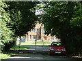
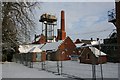
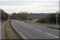
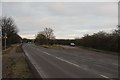
100 photos from this area
Area Information
Key information about the OX10 9QP including its size, population, and administrative classification.
- Area Type
- Postcode
- Area Size
- 9787 m²
- Population
- 1815
- Population Density
- 2217 people/km²
House Prices in OX10 9QP
17
Properties
£319,725
Average Sold Price
£155,250
Lowest Price
£485,000
Highest Price
Showing 17 properties
| Address | Type | Beds | Baths | Last Sale Price | Last Sale Date | |
|---|---|---|---|---|---|---|
| 11 Queens Road, Cholsey, Wallingford, OX10 9QP | Semi-detached | 3 | 1 | £345,000 | Dec 2022 | |
| 5 Queens Road, Cholsey, Wallingford, OX10 9QP | Semi-detached | 4 | 2 | £485,000 | Nov 2022 | |
| 13 Queens Road, Cholsey, Wallingford, OX10 9QP | house | - | - | £450,000 | Oct 2021 | |
| 14 Queens Road, Cholsey, Wallingford, OX10 9QP | Semi-detached | 3 | - | £375,000 | May 2016 | |
| 3 Queens Road, Cholsey, Wallingford, OX10 9QP | Bungalow | - | - | £305,000 | Jul 2015 | |
| 2 Queens Road, Cholsey, Wallingford, OX10 9QP | house | 4 | - | £270,000 | Oct 2012 | |
| 12 Queens Road, Cholsey, Wallingford, OX10 9QP | house | - | - | £265,000 | Sep 2011 | |
| 8 Queens Road, Cholsey, Wallingford, OX10 9QP | Semi-detached | - | - | £299,500 | Oct 2007 | |
| 6 Queens Road, Cholsey, Wallingford, OX10 9QP | Detached | - | - | £247,500 | Oct 2006 | |
| 17 Queens Road, Cholsey, Wallingford, OX10 9QP | Semi-detached | - | - | £155,250 | Nov 2000 |
Page 1 of 2
Energy Efficiency in OX10 9QP
Amenities
Schools
| Rank | School | Type | Entry gender | Ages |
|---|
Explore more schools in this area
Go to Schools tabDemographics
Household Size
Family (3-5 people)
most common
Accommodation Type
Houses
most common
Tenure
72
majority
Ethnic Group
White
most common
Religion
N/A
most common
Household Composition
N/A
most common
Age
47
median
Adults (30-64 years)
most common
Household Deprivation
N/A
with no deprivation
NS-SEC
47
in Lower managerial occupations
Explore more demographic insights in this area
Go to Demographics tabPlanning
Planning Constraints
- Flood RiskPremium
- Ramsar Wetland SitesPremium
- Area of Outstanding Natural BeautyPremium
- Protected Nature ReservePremium
- Protected WoodlandPremium