Area Overview for OX10 9AA
Photos of OX10 9AA
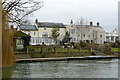
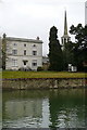
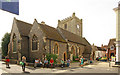
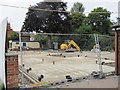

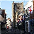
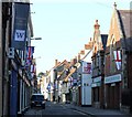
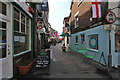
100 photos from this area
Area Information
Key information about the OX10 9AA including its size, population, and administrative classification.
- Area Type
- Postcode
- Area Size
- 7403 m²
- Population
- 2086
- Population Density
- 256 people/km²
House Prices in OX10 9AA
14
Properties
£273,250
Average Sold Price
£110,000
Lowest Price
£335,000
Highest Price
Showing 14 properties
| Address | Type | Beds | Baths | Last Sale Price | Last Sale Date | |
|---|---|---|---|---|---|---|
| 14 Lower Wharf, Wallingford, OX10 9AA | Terraced | 2 | 2 | £295,000 | Feb 2021 | |
| 12 Lower Wharf, Wallingford, OX10 9AA | Terraced | 2 | - | £275,000 | Sep 2020 | |
| 10 Lower Wharf, Wallingford, OX10 9AA | Semi-detached | 2 | 2 | £335,000 | Apr 2016 | |
| 18 Lower Wharf, Wallingford, OX10 9AA | Terraced | 2 | 2 | £329,500 | Mar 2016 | |
| 20 Lower Wharf, Wallingford, OX10 9AA | Semi-detached | - | - | £295,000 | Jun 2006 | |
| 16 Lower Wharf, Wallingford, OX10 9AA | house | 2 | - | £110,000 | Dec 1995 | |
| St Lucians, Lower Wharf, Wallingford, OX10 9AA | house | 2 | - | - | - | |
| 1 Lower Wharf, Wallingford, OX10 9AA | Terraced | 3 | 3 | - | - | |
| Mooring, The Boathouse, Lower Wharf, Wallingford, OX10 9AA | Leisure | - | - | - | - | |
| Upper Flat, St Lucians, Lower Wharf, Wallingford, OX10 9AA | Flat | - | - | - | - |
Page 1 of 2
Energy Efficiency in OX10 9AA
Amenities
Schools
| Rank | School | Type | Entry gender | Ages |
|---|
Explore more schools in this area
Go to Schools tabDemographics
Household Size
Family (3-5 people)
most common
Accommodation Type
Houses
most common
Tenure
80
majority
Ethnic Group
White
most common
Religion
N/A
most common
Household Composition
N/A
most common
Age
47
median
Adults (30-64 years)
most common
Household Deprivation
N/A
with no deprivation
NS-SEC
53
in Lower managerial occupations
Explore more demographic insights in this area
Go to Demographics tabPlanning
Planning Constraints
- Flood RiskPremium
- Ramsar Wetland SitesPremium
- Protected Nature ReservePremium
- Protected WoodlandPremium