Area Overview for OX10 8LJ
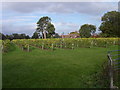
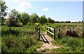
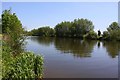
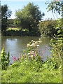
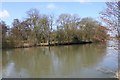
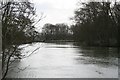
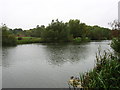
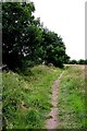
Photos of OX10 8LJ


Area Information
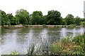
Living in OX10 8LJ offers a distinct experience characterised by low density and significant open space. This specific postcode covers a residential cluster spanning 45.7 hectares across Oxfordshire. With a population of 1,315 residents, the area maintains a low population density of 57 people per square kilometre. The environment prioritises a quiet residential atmosphere over urban convenience. Many residents rely on private vehicles or other transport methods due to the rural setting. The locality functions primarily as a home for those seeking solitude rather than city centre proximity. Daily life revolves around the immediate neighbourhood and nearby towns rather than a dense local high street within the cluster itself.
- Area Type
- Postcode
- Area Size
- 45.7 hectares
- Population
- 1315
- Population Density
- 57 people/km²
The housing market in OX10 8LJ is exclusively focused on house ownership. With 80 percent of properties occupied by their owners, the area caters almost entirely to owner-occupiers rather than renters. The accommodation type consists of houses, meaning you will not find flats or apartments as a primary housing stock. This structure implies that buyers are seeking detached or semi-detached family homes rather than urban-style living arrangements. The low population density of 57 people per square kilometre reinforces the nature of the housing, which is spread across 45.7 hectares. Potential buyers should expect a traditional country home environment. The high ownership rate, combined with the absence of a rental sector data point, indicates a settled community where sellers often target individuals looking for permanence.
House Prices in OX10 8LJ
Showing 10 properties
| Address | Type | Beds | Baths | Last Sale Price | Last Sale Date | |
|---|---|---|---|---|---|---|
| Rush Court Gardens, Shillingford Road, Shillingford Hill, Wallingford, OX10 8LJ | Bungalow | 4 | 2 | £1,025,000 | Dec 2020 | |
| Barn Cottage, Shillingford Road, Shillingford Hill, Wallingford, OX10 8LJ | Semi-detached | 5 | 3 | £345,000 | Jan 1999 | |
| Brightwell Vineyard, Shillingford Road, Shillingford Hill, Wallingford, OX10 8LJ | Detached | - | - | £630,000 | Aug 1998 | |
| The Bungalow, Rush Manor, Shillingford Road, Shillingford Hill, Wallingford, OX10 8LJ | Semi-detached | 2 | 2 | - | - | |
| Yew Cottage, Shillingford Road, Shillingford Hill, Wallingford, OX10 8LJ | Semi-detached | - | - | - | - | |
| Beech Cottage, Shillingford Road, Shillingford Hill, Wallingford, OX10 8LJ | Semi-detached | - | - | - | - | |
| Rush Court Nurseries, Shillingford Road, Shillingford Hill, Wallingford, OX10 8LJ | Detached | - | - | - | - | |
| Rush Manor, Shillingford Road, Shillingford Hill, Wallingford, OX10 8LJ | Detached | - | - | - | - | |
| Rush Barn, Shillingford Road, Shillingford Hill, Wallingford, OX10 8LJ | Semi-detached | - | - | - | - | |
| Mill House, Shillingford Road, Shillingford Hill, Wallingford, OX10 8LJ | hotel | - | - | - | - |
Energy Efficiency in OX10 8LJ
Resident lifestyle in OX10 8LJ depends on amenities located in nearby towns and villages. Retail options include M&S Benson Wallingford BP, Co-op Benson, and Asda Rectory, providing essential grocery and shopping needs. For transport connections, Cholsey Railway Station, Didcot Parkway Railway Station, and Appleford Railway Station lie within practical reach. These rail links offer access to wider Oxfordshire and London networks. The Wailingford Metro stop is also identified as a nearby transport node. Aviation interests are catered for by the presence of RAF Benson and Chalgrove Airport in the vicinity. While the immediate 45.7 hectare area is largely empty, these external amenities provide sufficient support for daily commerce and travel requirements.
Amenities
Schools
Families considering living in OX10 8LJ have access to Long Wittenham (Church of England) Primary School located nearby. This institution serves as the primary educational option for young children in the immediate vicinity. The school is designated as a Church of England primary institution, offering a faith-based educational framework. There are no secondary schools or specialist academies listed within the immediate data provided for this specific postcode cluster. Parents will need to look towards broader village services or neighbouring towns for older children's education. The presence of a single named primary school indicates a small catchment area for early education. While the school data is limited to this one entry, it represents the nearest provision for primary-aged students.
| Rank | School | Type | Entry gender | Ages |
|---|
Explore more schools in this area
Go to Schools tabDemographics
The community of OX10 8LJ is defined by a mature demographic profile. The median age stands at 47 years, reflecting a population dominated by adults aged between 30 and 64. Eighty percent of households in this area are owned outright or mortgage-free, indicating high levels of home ownership. This figure suggests stability and long-term residency rather than a transient rental market. Families residing here occupy a predominance of houses, aligning with the older age profile and ownership rates. The demographic landscape is mostly White, matching the broader county profile. There is no significant portion of the population under the age of 30, which shapes the social dynamic and demand for specific facilities. Homeownership constitutes the vast majority of the accommodation structure, distinguishing this neighbourhood from newer urban developments where renting is more common.
Household Size
Accommodation Type
Tenure
Ethnic Group
Religion
Household Composition
Age
Household Deprivation
NS-SEC
Explore more demographic insights in this area
Go to Demographics tabPlanning
Planning Constraints
- Flood RiskPremium
- Ramsar Wetland SitesPremium
- Area of Outstanding Natural BeautyPremium
- Protected Nature ReservePremium
- Protected WoodlandPremium