Area Overview for OX10 8FX
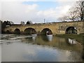
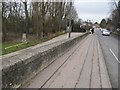
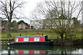
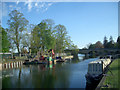
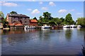
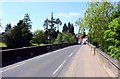
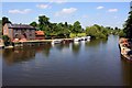
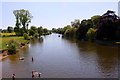
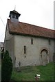
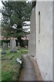
Photos of OX10 8FX


Area Information
OX10 8FX is a compact residential cluster covering 2.6 hectares. This small postcode area sits within the wider Oxfordshire landscape, serving approximately 1,026 people. The resulting population density of 476 people per square kilometre creates a low-traffic environment that feels separate from the urban core. Living in OX10 8FX means prioritising quiet over noise and spaciousness over density. You will find a settlement defined by its size rather than any large commercial hub or population centre. The area functions as a sleeping community with direct links to nearby services. Its small footprint ensures that daily routes remain short if you commute to Wallingford or Didcot. You do not experience the congestion of larger neighbourhooods here. Instead, you enjoy a rural setting that balances privacy with access to essential transport routes. The layout supports a slow pace of life, where local walkability replaces the need for extensive car travel within the immediate vicinity. This makes the location ideal for those seeking a retreat without total isolation.
- Area Type
- Postcode
- Area Size
- 2.6 hectares
- Population
- 1026
- Population Density
- 476 people/km²
The property market in OX10 8FX is characterised by a high degree of stability. A staggering 79% of residents own their homes outright. This leaves only about 21% of the housing stock available as long-term or short-term rentals. Such a skewed ratio indicates that this is not a first-time buyer area but a destination for established homeowners. The 2.6 hectares of land absorb just over 1,000 people, limiting supply and maintaining value. Homes in OX10 8FX are almost exclusively houses. This preference for detached or semi-detached properties aligns with the rural classification of the postcode. You will find very few apartments or purpose-built flats in this specific cluster. The architecture likely reflects traditional rural designs suited to the local climate and planning constraints. For buyers looking at this area, the market operates with an eye on owner-occupier pillars rather than investment properties for tenants.
House Prices in OX10 8FX
Showing 61 properties
| Address | Type | Beds | Baths | Last Sale Price | Last Sale Date | |
|---|---|---|---|---|---|---|
| 51 Mcculloch Meadows, Crowmarsh Gifford, Wallingford, OX10 8FX | Bungalow | - | - | £575,000 | Aug 2023 | |
| 38 Mcculloch Meadows, Crowmarsh Gifford, Wallingford, OX10 8FX | house | - | - | £280,000 | Apr 2023 | |
| 40 Mcculloch Meadows, Crowmarsh Gifford, Wallingford, OX10 8FX | house | - | - | £280,000 | Mar 2023 | |
| 42 Mcculloch Meadows, Crowmarsh Gifford, Wallingford, OX10 8FX | house | - | - | £280,000 | Mar 2023 | |
| 49 Mcculloch Meadows, Crowmarsh Gifford, Wallingford, OX10 8FX | Bungalow | - | - | £575,000 | Mar 2023 | |
| 16 Mcculloch Meadows, Crowmarsh Gifford, Wallingford, OX10 8FX | house | - | - | £390,250 | Dec 2022 | |
| 14 Mcculloch Meadows, Crowmarsh Gifford, Wallingford, OX10 8FX | house | - | - | £390,000 | Dec 2022 | |
| 18 Mcculloch Meadows, Crowmarsh Gifford, Wallingford, OX10 8FX | house | - | - | £390,000 | Dec 2022 | |
| 20 Mcculloch Meadows, Crowmarsh Gifford, Wallingford, OX10 8FX | house | - | - | £390,000 | Dec 2022 | |
| 25 Mcculloch Meadows, Crowmarsh Gifford, Wallingford, OX10 8FX | Detached | 2 | 1 | £375,000 | Sep 2022 |
Energy Efficiency in OX10 8FX
Ample amenities lie within practical reach of OX10 8FX, removing the need for daily car trips to larger towns. Retail options are solid, with five notable shops within easy reach. You can shop at Waitrose Wallingford for premium groceries, visit Asda Rectory for larger supermarket runs, or choose Lidl Lupton Road for budget options. Dining and leisure choices expand in the nearest market towns. Transport links bring wider opportunities without sacrificing the quiet environment of the 2.6-hectare area. Rail services access Wallingford, Cholsey Railway Station, Goring & Streatley Railway Station, and Didcot Parkway Railway Station. These stations connect you to Oxford, London, and Birmingham. Two airports, RAF Benson and Chalgrove Airport, are nearby for flight connections. This combination of local convenience and regional access defines the lifestyle here. You enjoy the benefits of rural living with urban services at your fingertips.
Amenities
Schools
Families in OX10 8FX have access to a single primary education option within the immediate vicinity. Crowmarsh Gifford Church of England School serves as the designated primary provider for the area. This institution holds a 'good' Ofsted rating, indicating a standard of education that meets national expectations. The absence of secondary schools listed for this specific postcode means that older children will require travel to larger towns like Wallingford or Didcot for secondary education. The single primary option creates a tight-knit educational community where parents often connect through school gates. The 'good' rating provides reassurance for those evaluating the quality of life in OX10 8FX. School run traffic concentrates around this one facility during term time, with no competing institutions in the immediate 2.6-hectare zone. You must consider catchment areas for nursery care or secondary placement when viewing properties here. The reliance on one good-rated primary school simplifies the decision for the first few years of schooling but requires planning for later stages.
| Rank | School | Type | Entry gender | Ages |
|---|
Explore more schools in this area
Go to Schools tabDemographics
The community in OX10 8FX presents a distinctly mature profile. The median age sits at 47 years, reflecting a demographic heavy in the 30 to 64 age range. This indicates a family-oriented and established community rather than a student or young professional hub. Nearly four out of five residents own their homes, with a home ownership rate of 79%. Such a high figure suggests financial stability and long-term扎根 in the area. Accommodation types are predominantly houses, fitting the rural character of the 2.6-hectare location. This approach to housing contrasts with the flats common in city centres. The predominant ethnic group is White, mirroring the demographic structure of much of rural Oxfordshire. With nearly 80% of households being owner-occupied, the neighbourhood relies heavily on personal investment rather than rental income. This demographic makeup supports local businesses that cater to families and retirees, such as the Waitrose and Lidl nearby.
Household Size
Accommodation Type
Tenure
Ethnic Group
Religion
Household Composition
Age
Household Deprivation
NS-SEC
Explore more demographic insights in this area
Go to Demographics tabPlanning
Planning Constraints
- Flood RiskPremium
- Ramsar Wetland SitesPremium
- Area of Outstanding Natural BeautyPremium
- Protected Nature ReservePremium
- Protected WoodlandPremium