Area Overview for OX10 8DA
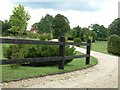
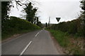
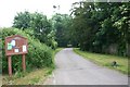
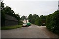
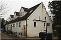
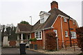
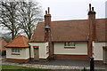
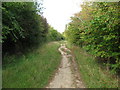
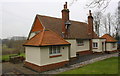
Photos of OX10 8DA


Area Information
Living in OX10 8DA offers a specific type of residential experience within a defined cluster of properties. This postcode covers approximately 7.5 hectares of land in England, creating a contained environment for its residents. With a total population of 2,069 individuals, the area feels intimate yet established. The layout supports a community where neighbours likely know one another, given the relatively low density of 61 people per square kilometre. You will find yourself balancing access to local amenities with the quiet of a suburban setting. The location serves as a home base for families and individuals who value a distinct separation from the busiest parts of Oxford while retaining decent infrastructure. The small size of the postcode ensures that journey times to local services remain manageable. Daily life here is structured around a blend of quiet residential streets and practical access points to the wider region. As you move through the cluster, you encounter a neighbourhood designed for steady living rather than rapid urban development.
- Area Type
- Postcode
- Area Size
- 7.5 hectares
- Population
- 2069
- Population Density
- 61 people/km²
The housing stock in OX10 8DA is characterised by a strong owner-occupier base. Since 67% of households own their homes, the area functions more as a investable and settled market than a rental hub. The predominant accommodation type comprises houses, which aligns with the lifestyle choices of the 30 to 64 year-old demographic that forms the bulk of the population. You will find fewer purpose-built rental units compared to owner-occupied detached or semi-detached properties. This structure makes the area attractive for families seeking long-term stability and for second-home buyers looking for a reliable English retirement address. The small scale of the postcode, covering only 7.5 hectares, means supply is naturally limited compared to larger urban districts. Consequently, demand often holds property values steady. The market reflects a traditional English suburb where chains can sometimes form simply because the majority of transactions involve moving between owner-occupied homes rather than renting.
House Prices in OX10 8DA
Showing 16 properties
| Address | Type | Beds | Baths | Last Sale Price | Last Sale Date | |
|---|---|---|---|---|---|---|
| Box Tree House, Mongewell Park, Mongewell, Wallingford, OX10 8DA | house | - | - | £900,000 | Aug 2024 | |
| The Lake House, Mongewell Park, Mongewell, Wallingford, OX10 8DA | Detached | - | - | £651,000 | Jul 2022 | |
| Lychgate House, Mongewell Park, Mongewell, Wallingford, OX10 8DA | Detached | 3 | 3 | £900,000 | May 2018 | |
| Waterside House, Mongewell Park, Mongewell, Wallingford, OX10 8DA | Detached | 4 | 1 | £1,250,000 | Nov 2016 | |
| Watersview House, Mongewell Park, Mongewell, Wallingford, OX10 8DA | Detached | 4 | - | £1,000,000 | Jan 2014 | |
| The Old Walled Garden, Mongewell Park, Mongewell, Wallingford, OX10 8DA | house | - | - | £375,000 | Jul 2013 | |
| Willow Lake, Mongewell Park, Mongewell, Wallingford, OX10 8DA | house | - | - | £400,000 | Jul 2013 | |
| Lake Farm House, Mongewell Park, Mongewell, Wallingford, OX10 8DA | Detached | 5 | 3 | £425,000 | Dec 2000 | |
| St Johns House, Mongewell Park, Mongewell, Wallingford, OX10 8DA | Detached | 4 | 4 | £350,000 | Jun 1999 | |
| Mere Cottage, Lake Walk, Mongewell Park, Mongewell, Wallingford, OX10 8DA | Detached | 4 | 3 | - | - |
Energy Efficiency in OX10 8DA
Residents of OX10 8DA benefit from a practical selection of shopping and transport facilities within easy reach. The local retail scene is anchored by five major locations including Waitrose Wallingford, Lidl Lupton Road, and Asda Rectory. These venues provide the daily necessities and supermarket options required for typical household management. For rail commuters, the area is positioned near Goring and Streatley Railway Station, Didcot Parkway Railway Station, and Cholsey Railway Station, facilitating travel across the wider region. Transport links are further supported by Wallingford station and the proximity to RAF Benson, which serves as a local airport. You do not need to travel far for grocery shopping or general commerce. The concentration of these five retail points ensures that day-to-day tasks are handled without excessive driving. This balance of accessible supermarkets and rail hubs defines the convenience of living in this specific cluster.
Amenities
Schools
Families residing in OX10 8DA have access to two independent educational institutions within their catchment proximity. Carmel College stands alongside Turners Court School as the nearest options for secondary education. Both schools operate as independent institutions, offering a private educational environment distinct from state-maintained comprehensive schools. This mix means parents considering homes in OX10 8DA are primarily looking at the independent sector for their children's education. There is no data provided regarding Ofsted ratings or specific age ranges for these schools, but their presence defines the educational character of the immediate surroundings. The availability of independent schooling often correlates with the high level of home ownership seen in the area, suggesting families are prepared for alternative educational pathways. For parents making decisions about living in this postcode, the presence of these two specific colleges is the key educational factor.
| Rank | School | Type | Entry gender | Ages |
|---|
Explore more schools in this area
Go to Schools tabDemographics
The community in OX10 8DA is defined by a mature and stable population profile. The median age stands at 47 years, confirming that adults aged between 30 and 64 years represent the most common age range in the area. This demographic skew suggests a neighbourhood settled by families and professionals rather than students or young singles. Home ownership is the dominant form of tenure, with 67% of residents owning their properties outright or with a mortgage. Accommodation primarily consists of houses, reflecting the preference for family-sized living spaces over high-density flats. The predominant ethnic group within the community identifies as White, which aligns with the broader demographic trends of the region. There is no specific data available regarding deprivation indices or income levels within the provided documentation, but the high ownership rate indicates financial stability among many households. The age distribution points away from a transient population and toward long-term residents who have established roots in the local area.
Household Size
Accommodation Type
Tenure
Ethnic Group
Religion
Household Composition
Age
Household Deprivation
NS-SEC
Explore more demographic insights in this area
Go to Demographics tabPlanning
Planning Constraints
- Flood RiskPremium
- Ramsar Wetland SitesPremium
- Area of Outstanding Natural BeautyPremium
- Protected Nature ReservePremium
- Protected WoodlandPremium