Area Overview for OX10 7PY
Photos of OX10 7PY
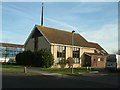
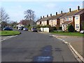

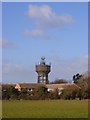
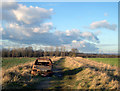
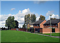
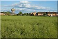
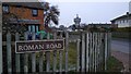
49 photos from this area
Area Information
Key information about the OX10 7PY including its size, population, and administrative classification.
- Area Type
- Postcode
- Area Size
- 2.4 hectares
- Population
- 1531
- Population Density
- 499 people/km²
House Prices in OX10 7PY
39
Properties
£197,433
Average Sold Price
£37,000
Lowest Price
£310,000
Highest Price
Showing 39 properties
| Address | Type | Beds | Baths | Last Sale Price | Last Sale Date | |
|---|---|---|---|---|---|---|
| 9 Lodden Avenue, Berinsfield, Wallingford, OX10 7PY | Semi-detached | 3 | 1 | £308,500 | Jan 2023 | |
| 3 Lodden Avenue, Berinsfield, Wallingford, OX10 7PY | Terraced | 3 | 1 | £310,000 | Jul 2022 | |
| 15 Lodden Avenue, Berinsfield, Wallingford, OX10 7PY | Semi-detached | 3 | 1 | £300,000 | Mar 2022 | |
| 57 Lodden Avenue, Berinsfield, Wallingford, OX10 7PY | house | - | - | £272,000 | Oct 2021 | |
| 41 Lodden Avenue, Berinsfield, Wallingford, OX10 7PY | Terraced | 3 | 1 | £250,000 | Jan 2020 | |
| 49 Lodden Avenue, Berinsfield, Wallingford, OX10 7PY | Terraced | 3 | 1 | £212,500 | Feb 2018 | |
| 37 Lodden Avenue, Berinsfield, Wallingford, OX10 7PY | Terraced | 3 | 1 | £245,000 | Jul 2016 | |
| 27 Lodden Avenue, Berinsfield, Wallingford, OX10 7PY | Terraced | 3 | 1 | £165,000 | Jun 2015 | |
| 5 Lodden Avenue, Berinsfield, Wallingford, OX10 7PY | Terraced | 3 | 1 | £160,000 | Mar 2014 | |
| 1 Lodden Avenue, Berinsfield, Wallingford, OX10 7PY | house | 3 | - | £168,000 | Nov 2010 |
Page 1 of 4
Energy Efficiency in OX10 7PY
Amenities
Schools
| Rank | School | Type | Entry gender | Ages |
|---|
Explore more schools in this area
Go to Schools tabDemographics
Household Size
Family (3-5 people)
most common
Accommodation Type
Houses
most common
Tenure
57
majority
Ethnic Group
White
most common
Religion
N/A
most common
Household Composition
N/A
most common
Age
47
median
Adults (30-64 years)
most common
Household Deprivation
N/A
with no deprivation
NS-SEC
23
in Lower managerial occupations
Explore more demographic insights in this area
Go to Demographics tabPlanning
Planning Constraints
- Flood RiskPremium
- Ramsar Wetland SitesPremium
- Area of Outstanding Natural BeautyPremium
- Protected Nature ReservePremium
- Protected WoodlandPremium