Area Overview for OX10 7JP
Photos of OX10 7JP
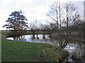
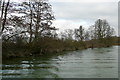
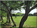
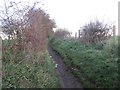
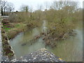
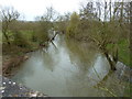
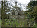
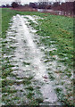

101 photos from this area
Area Information
Key information about the OX10 7JP including its size, population, and administrative classification.
- Area Type
- Postcode
- Area Size
- 1.7 hectares
- Population
- 1679
- Population Density
- 170 people/km²
House Prices in OX10 7JP
19
Properties
£508,939
Average Sold Price
£138,000
Lowest Price
£1,250,000
Highest Price
Showing 19 properties
| Address | Type | Beds | Baths | Last Sale Price | Last Sale Date | |
|---|---|---|---|---|---|---|
| 22 Bridge End, Dorchester On Thames, Wallingford, OX10 7JP | Detached | 2 | 1 | £540,000 | Jul 2024 | |
| 6C Bridge End, Dorchester On Thames, Wallingford, OX10 7JP | Terraced | 3 | 2 | £505,000 | Jul 2024 | |
| 14 Bridge End, Dorchester On Thames, Wallingford, OX10 7JP | Bungalow | 2 | 3 | £993,530 | Nov 2023 | |
| 6B Bridge End, Dorchester On Thames, Wallingford, OX10 7JP | house | - | - | £327,000 | May 2022 | |
| 28 Bridge End, Dorchester On Thames, Wallingford, OX10 7JP | Terraced | - | - | £250,000 | Jan 2021 | |
| 12 Bridge End, Dorchester On Thames, Wallingford, OX10 7JP | Detached | 3 | 2 | £695,000 | Feb 2019 | |
| The Chequers, 20 Bridge End, Dorchester On Thames, Wallingford, OX10 7JP | Detached | 5 | 2 | £945,000 | Sep 2017 | |
| 26 Bridge End, Dorchester On Thames, Wallingford, OX10 7JP | Cottage | 2 | 1 | £385,000 | Jul 2017 | |
| 18 Bridge End, Dorchester On Thames, Wallingford, OX10 7JP | Detached | 4 | 2 | £565,000 | Oct 2016 | |
| 24 Bridge End, Dorchester On Thames, Wallingford, OX10 7JP | house | - | - | £1,250,000 | Dec 2010 |
Page 1 of 2
Energy Efficiency in OX10 7JP
Amenities
Schools
| Rank | School | Type | Entry gender | Ages |
|---|
Explore more schools in this area
Go to Schools tabDemographics
Household Size
Two person
most common
Accommodation Type
Houses
most common
Tenure
79
majority
Ethnic Group
White
most common
Religion
N/A
most common
Household Composition
N/A
most common
Age
47
median
Adults (30-64 years)
most common
Household Deprivation
N/A
with no deprivation
NS-SEC
53
in Lower managerial occupations
Explore more demographic insights in this area
Go to Demographics tabPlanning
Planning Constraints
- Flood RiskPremium
- Ramsar Wetland SitesPremium
- Area of Outstanding Natural BeautyPremium
- Protected Nature ReservePremium
- Protected WoodlandPremium