Area Overview for OX10 7EW
Photos of OX10 7EW
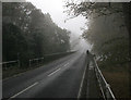
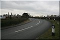
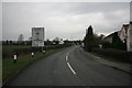


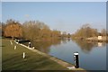


100 photos from this area
Area Information
Key information about the OX10 7EW including its size, population, and administrative classification.
- Area Type
- Postcode
- Area Size
- 22.1 hectares
- Population
- 1679
- Population Density
- 170 people/km²
House Prices in OX10 7EW
18
Properties
£815,714
Average Sold Price
£500,000
Lowest Price
£1,200,000
Highest Price
Showing 18 properties
| Address | Type | Beds | Baths | Last Sale Price | Last Sale Date | |
|---|---|---|---|---|---|---|
| Downgate House, 25 Wharf Road, Shillingford, Wallingford, OX10 7EW | Detached | 5 | 3 | £1,200,000 | Sep 2018 | |
| Twittens, 23 Wharf Road, Shillingford, Wallingford, OX10 7EW | house | 5 | - | £1,150,000 | Jun 2014 | |
| The Nook, 17 Wharf Road, Shillingford, Wallingford, OX10 7EW | Detached | 6 | 3 | £620,000 | Nov 2003 | |
| Swan Cottage, 39 Wharf Road, Shillingford, Wallingford, OX10 7EW | Detached | 5 | 3 | £780,000 | Sep 2003 | |
| The Lo'ans, 19 Wharf Road, Shillingford, Wallingford, OX10 7EW | Detached | - | - | £785,000 | May 2003 | |
| Riverside House, 31 Wharf Road, Shillingford, Wallingford, OX10 7EW | Detached | 6 | 2 | £500,000 | Apr 1997 | |
| Old Wharf, 35 Wharf Road, Shillingford, Wallingford, OX10 7EW | house | 6 | 4 | £675,000 | Nov 1996 | |
| Shillingford Farm, 8 Wharf Road, Shillingford, Wallingford, OX10 7EW | Detached | 5 | 4 | - | - | |
| The Old Post Office, 5 Wharf Road, Shillingford, Wallingford, OX10 7EW | Detached | - | - | - | - | |
| The Hay Loft, Wharf Road, Shillingford, Wallingford, OX10 7EW | Maisonette | 2 | 1 | - | - |
Page 1 of 2
Energy Efficiency in OX10 7EW
Amenities
Schools
| Rank | School | Type | Entry gender | Ages |
|---|
Explore more schools in this area
Go to Schools tabDemographics
Household Size
Two person
most common
Accommodation Type
Houses
most common
Tenure
79
majority
Ethnic Group
White
most common
Religion
N/A
most common
Household Composition
N/A
most common
Age
47
median
Adults (30-64 years)
most common
Household Deprivation
N/A
with no deprivation
NS-SEC
53
in Lower managerial occupations
Explore more demographic insights in this area
Go to Demographics tabPlanning
Planning Constraints
- Flood RiskPremium
- Ramsar Wetland SitesPremium
- Area of Outstanding Natural BeautyPremium
- Protected Nature ReservePremium
- Protected WoodlandPremium