Area Overview for OX10 6JB
Photos of OX10 6JB
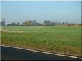
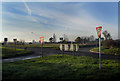
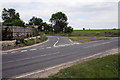
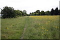
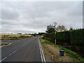
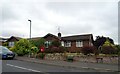
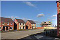
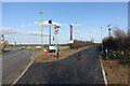
25 photos from this area
Area Information
Key information about the OX10 6JB including its size, population, and administrative classification.
- Area Type
- Postcode
- Area Size
- 64.0 hectares
- Population
- 1444
- Population Density
- 330 people/km²
House Prices in OX10 6JB
24
Properties
£463,458
Average Sold Price
£200,000
Lowest Price
£1,300,000
Highest Price
Showing 24 properties
| Address | Type | Beds | Baths | Last Sale Price | Last Sale Date | |
|---|---|---|---|---|---|---|
| Montrose House, Roke Marsh, Roke, Wallingford, OX10 6JB | Detached | 5 | 2 | £1,300,000 | Oct 2021 | |
| Holly Tree Cottage, Roke Marsh, Roke, Wallingford, OX10 6JB | Detached | - | - | £385,000 | Nov 2009 | |
| Kimbars, Roke Marsh, Roke, Wallingford, OX10 6JB | Semi-detached | - | - | £230,000 | Feb 2006 | |
| Wellings, Roke Marsh, Roke, Wallingford, OX10 6JB | Semi-detached | - | - | £315,000 | Jun 2005 | |
| Ten Trees, Roke Marsh, Roke, Wallingford, OX10 6JB | Detached | - | - | £200,000 | Oct 2004 | |
| Meadow View, Roke Marsh, Roke, Wallingford, OX10 6JB | Detached | - | - | £675,000 | Feb 2004 | |
| South House, Roke Marsh, Roke, Wallingford, OX10 6JB | Detached | - | - | £420,000 | Dec 2003 | |
| Porthill House, Roke Marsh, Roke, Wallingford, OX10 6JB | Detached | - | - | £550,000 | Nov 2003 | |
| Treyarnon, Roke Marsh, Roke, Wallingford, OX10 6JB | Semi-detached | 3 | 1 | £209,000 | Oct 2003 | |
| North House, Roke Marsh, Roke, Wallingford, OX10 6JB | Detached | - | - | £420,000 | Aug 2003 |
Page 1 of 3
Energy Efficiency in OX10 6JB
Amenities
Schools
| Rank | School | Type | Entry gender | Ages |
|---|
Explore more schools in this area
Go to Schools tabDemographics
Household Size
Two person
most common
Accommodation Type
Houses
most common
Tenure
87
majority
Ethnic Group
White
most common
Religion
N/A
most common
Household Composition
N/A
most common
Age
47
median
Adults (30-64 years)
most common
Household Deprivation
N/A
with no deprivation
NS-SEC
46
in Lower managerial occupations
Explore more demographic insights in this area
Go to Demographics tabPlanning
Planning Constraints
- Flood RiskPremium
- Ramsar Wetland SitesPremium
- Area of Outstanding Natural BeautyPremium
- Protected Nature ReservePremium
- Protected WoodlandPremium