Area Overview for OX10 6FP
Photos of OX10 6FP
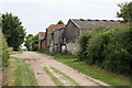
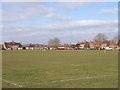
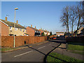
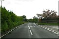
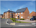
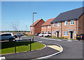
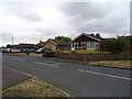
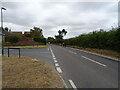
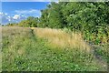
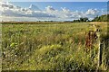
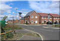
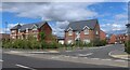
23 photos from this area
Area Information
Key information about the OX10 6FP including its size, population, and administrative classification.
- Area Type
- Postcode
- Area Size
- 9592 m²
- Population
- 1997
- Population Density
- 877 people/km²
House Prices in OX10 6FP
30
Properties
£541,575
Average Sold Price
£400,000
Lowest Price
£655,000
Highest Price
Showing 30 properties
| Address | Type | Beds | Baths | Last Sale Price | Last Sale Date | |
|---|---|---|---|---|---|---|
| 21 Maple Furlong, Benson, Wallingford, OX10 6FP | house | - | - | £590,000 | Oct 2022 | |
| 26 Maple Furlong, Benson, Wallingford, OX10 6FP | house | - | - | £630,000 | May 2022 | |
| 15 Maple Furlong, Benson, Wallingford, OX10 6FP | house | - | - | £400,000 | May 2022 | |
| 22 Maple Furlong, Benson, Wallingford, OX10 6FP | Detached | 4 | 3 | £585,000 | May 2022 | |
| 24 Maple Furlong, Benson, Wallingford, OX10 6FP | house | - | - | £585,000 | Apr 2022 | |
| 11 Maple Furlong, Benson, Wallingford, OX10 6FP | house | - | - | £450,000 | Apr 2022 | |
| 9 Maple Furlong, Benson, Wallingford, OX10 6FP | house | - | - | £655,000 | Mar 2022 | |
| 1 Maple Furlong, Benson, Wallingford, OX10 6FP | house | - | - | £437,600 | Feb 2022 | |
| 2 Maple Furlong, Benson, Wallingford, OX10 6FP | Flat | - | - | - | - | |
| 25 Maple Furlong, Benson, Wallingford, OX10 6FP | house | - | - | - | - |
Page 1 of 3
Energy Efficiency in OX10 6FP
Amenities
Schools
| Rank | School | Type | Entry gender | Ages |
|---|
Explore more schools in this area
Go to Schools tabDemographics
Household Size
Two person
most common
Accommodation Type
Houses
most common
Tenure
74
majority
Ethnic Group
White
most common
Religion
N/A
most common
Household Composition
N/A
most common
Age
47
median
Adults (30-64 years)
most common
Household Deprivation
N/A
with no deprivation
NS-SEC
48
in Lower managerial occupations
Explore more demographic insights in this area
Go to Demographics tabPlanning
Planning Constraints
- Flood RiskPremium
- Ramsar Wetland SitesPremium
- Area of Outstanding Natural BeautyPremium
- Protected Nature ReservePremium
- Protected WoodlandPremium