Area Overview for OX10 6BL
Photos of OX10 6BL
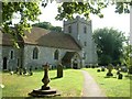
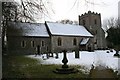
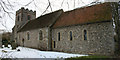
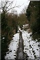
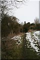
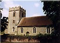
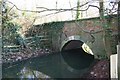

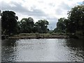
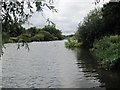
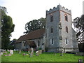
100 photos from this area
Area Information
Key information about the OX10 6BL including its size, population, and administrative classification.
- Area Type
- Postcode
- Area Size
- 34.6 hectares
- Population
- 2069
- Population Density
- 61 people/km²
House Prices in OX10 6BL
23
Properties
£911,286
Average Sold Price
£230,000
Lowest Price
£3,100,000
Highest Price
Showing 23 properties
| Address | Type | Beds | Baths | Last Sale Price | Last Sale Date | |
|---|---|---|---|---|---|---|
| Prospect House, The Street, North Stoke, Wallingford, OX10 6BL | Detached | 5 | 2 | £1,375,000 | Jun 2024 | |
| Brook Cottage, The Street, North Stoke, Wallingford, OX10 6BL | house | - | - | £1,250,000 | Sep 2021 | |
| The Mill House, The Street, North Stoke, Wallingford, OX10 6BL | Detached | 7 | 5 | £3,100,000 | Oct 2020 | |
| The Old School Rooms, The Street, North Stoke, Wallingford, OX10 6BL | Detached | 4 | 4 | £370,000 | Sep 2020 | |
| Days Cottage, The Street, North Stoke, Wallingford, OX10 6BL | house | - | - | £1,325,000 | Aug 2018 | |
| 3 The Street, North Stoke, Wallingford, OX10 6BL | Cottage | 4 | 2 | £615,000 | Feb 2016 | |
| Ryans Cottage, The Street, North Stoke, Wallingford, OX10 6BL | Detached | 2 | 1 | £299,000 | Dec 2015 | |
| Willow Cottage, The Street, North Stoke, Wallingford, OX10 6BL | Bungalow | 3 | - | £604,000 | Oct 2010 | |
| Archgate, The Street, North Stoke, Wallingford, OX10 6BL | Bungalow | - | - | £940,000 | Jul 2010 | |
| The Grange, The Street, North Stoke, Wallingford, OX10 6BL | house | - | - | £1,450,000 | Dec 2006 |
Page 1 of 3
Energy Efficiency in OX10 6BL
Amenities
Schools
| Rank | School | Type | Entry gender | Ages |
|---|
Explore more schools in this area
Go to Schools tabDemographics
Household Size
Family (3-5 people)
most common
Accommodation Type
Houses
most common
Tenure
67
majority
Ethnic Group
White
most common
Religion
N/A
most common
Household Composition
N/A
most common
Age
47
median
Adults (30-64 years)
most common
Household Deprivation
N/A
with no deprivation
NS-SEC
34
in Lower managerial occupations
Explore more demographic insights in this area
Go to Demographics tabPlanning
Planning Constraints
- Flood RiskPremium
- Ramsar Wetland SitesPremium
- Area of Outstanding Natural BeautyPremium
- Protected Nature ReservePremium
- Protected WoodlandPremium