Area Overview for OX10 0RL
Photos of OX10 0RL
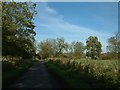


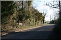

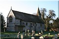
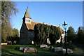
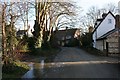
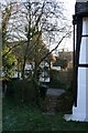

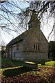

100 photos from this area
Area Information
Key information about the OX10 0RL including its size, population, and administrative classification.
- Area Type
- Postcode
- Area Size
- 2.3 hectares
- Population
- 1244
- Population Density
- 424 people/km²
House Prices in OX10 0RL
19
Properties
£595,714
Average Sold Price
£222,500
Lowest Price
£950,000
Highest Price
Showing 19 properties
| Address | Type | Beds | Baths | Last Sale Price | Last Sale Date | |
|---|---|---|---|---|---|---|
| 12 Monks Mead, Brightwell Cum Sotwell, Wallingford, OX10 0RL | Detached | 4 | 1 | £945,000 | Jun 2024 | |
| 6 Monks Mead, Brightwell Cum Sotwell, Wallingford, OX10 0RL | Detached | 4 | 2 | £865,000 | May 2024 | |
| 3 Monks Mead, Brightwell Cum Sotwell, Wallingford, OX10 0RL | Retail | 4 | 1 | £657,500 | Apr 2022 | |
| 21 Monks Mead, Brightwell Cum Sotwell, Wallingford, OX10 0RL | Detached | 4 | 2 | £880,000 | Oct 2020 | |
| 16 Monks Mead, Brightwell Cum Sotwell, Wallingford, OX10 0RL | Detached | 5 | 3 | £950,000 | Apr 2017 | |
| 7 Monks Mead, Brightwell Cum Sotwell, Wallingford, OX10 0RL | Detached | 5 | - | £606,000 | Dec 2014 | |
| 13 Monks Mead, Brightwell Cum Sotwell, Wallingford, OX10 0RL | Detached | 4 | 2 | £645,000 | Aug 2014 | |
| 14 Monks Mead, Brightwell Cum Sotwell, Wallingford, OX10 0RL | house | 4 | - | £675,000 | Sep 2012 | |
| 15 Monks Mead, Brightwell Cum Sotwell, Wallingford, OX10 0RL | house | - | - | £475,000 | Oct 2009 | |
| 8 Monks Mead, Brightwell Cum Sotwell, Wallingford, OX10 0RL | Detached | - | - | £499,000 | Aug 2008 |
Page 1 of 2
Energy Efficiency in OX10 0RL
Amenities
Schools
| Rank | School | Type | Entry gender | Ages |
|---|
Explore more schools in this area
Go to Schools tabDemographics
Household Size
Family (3-5 people)
most common
Accommodation Type
Houses
most common
Tenure
83
majority
Ethnic Group
White
most common
Religion
N/A
most common
Household Composition
N/A
most common
Age
47
median
Adults (30-64 years)
most common
Household Deprivation
N/A
with no deprivation
NS-SEC
48
in Lower managerial occupations
Explore more demographic insights in this area
Go to Demographics tabPlanning
Planning Constraints
- Flood RiskPremium
- Ramsar Wetland SitesPremium
- Area of Outstanding Natural BeautyPremium
- Protected Nature ReservePremium
- Protected WoodlandPremium