Area Overview for OX10 0LW
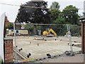
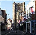
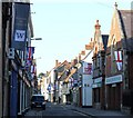
Photos of OX10 0LW


Area Information
The postcode OX10 0LW represents a specific residential cluster with a defined population of 2,265 people. This neighbourhood functions as a small, contained community rather than a sprawling urban district. Residents enjoy a settled environment characterised by the presence of substantial housing stock. The area benefits from a strategic location near Wallingford, providing easy access to local rail connections at Cholsey, Didcot Parkway, and Appleford stations. You can reach nearby transport hubs and retail outlets within practical reach, including the town centre of Wallingford and major supermarkets like Asda Rectory and Waitrose. The region sits in a safe zone with no designated planning constraints such as Areas of Outstanding Natural Beauty or protected woodlands. Digital infrastructure supports modern living, offering fixed broadband and mobile coverage of a reasonable quality for remote work or daily communication. Living in OX10 0LW means balancing the quiet of a residential pocket with the convenience of being close to key amenities and public transport links.
- Area Type
- Postcode
- Area Size
- Not available
- Population
- 2265
- Population Density
- 5769 people/km²
The housing stock in OX10 0LW is primarily composed of houses rather than flats or high-rise apartments. This preference for detached and semi-detached homes aligns with the area’s character as a traditional residential pocket. With 58% of homes being owner-occupied, the market functions heavily on ownership rather than the rental sectors found in larger cities. Buyers looking for homes in OX10 0LW should expect property values to reflect a desire for space and garden land. The low density means noise levels remain low compared to urban equivalents. You will not find luxury apartment blocks or purpose-built student accommodations within this specific postcode. Instead, the market centres on family-sized properties suitable for the predominant 30-64 age group. If you are eyeing a property purchase, competition often arises from families seeking a foothold in Oxfordshire education catchments. The lack of mixed-use high-density blocks simplifies the search for those prioritising quiet streets over proximity to nightlife.
House Prices in OX10 0LW
No properties found in this postcode.
Energy Efficiency in OX10 0LW
Daily life in OX10 0LW revolves around convenience and local access without the need for long drives. Within practical reach, you will find five key retail locations serving the community. These include Asda Rectory, Waitrose Wallingford, and Lidl on Lupton Road, ensuring all household groceries and gifts are available nearby. For rail education, the town offers connections via Wallingford station, which serves as the main metro hub for the district. You do not need to travel far for leisure or regular shopping trips. Five railway stations cluster around the region, providing flexibility in your travel routes to Cholsey, Didcot Parkway, and Appleford. Two nearby airports, RAF Benson and Chalgrove Airport, add variety for occasional flights or cargo logistics. The area lacks commercial districts with banks and post offices on every corner, so you rely on the designated town centre for most services. However, the concentration of supermarkets and rail-linked towns means you maintain a suburban comfort level with easy access to broader Amenities.
Amenities
Schools
Families living in OX10 0LW have access to two primary education institutions listed in the immediate vicinity. The nearest option is St Nicholas' Church of England Infants' School and Nursery Class in Wallingford. This institution operates under the academy trust model while providing early years education up to the infant stage. Children in this age range will attend this facility rather than junior or secondary schools located further away. The school hosts a nursery class, offering convenience for parents with young dependents who prefer local registration. Both educational entities share the same name and location, indicating a dedicated site for younger children. There are no secondary schools listed directly within the provided data for immediate access, suggesting families often drive to neighbouring towns for older children's education. This setup means you must plan transport for adolescence, though the proximity to Wallingford station aids occasional trips. The academic performance of these specific academies is not recorded here, so you should verify current Ofsted ratings independently before commitment.
| Rank | School | Type | Entry gender | Ages |
|---|
Explore more schools in this area
Go to Schools tabDemographics
The community in OX10 0LW is defined by a stable age profile with a median age of 47 years. Most residents fall into the adult bracket between 30 and 64 years old. This demographic skew suggests a neighbourhood comprising established households rather than students or young professionals moving frequently for short-term work. Housing ownership remains strong, with 58% of residents owning their homes outright or with a mortgage. The remaining population likely comprises tenants or shared owners. Families and couples form the core of this social fabric. The local ethnic composition is predominantly White, reflecting the traditional makeup of many Oxfordshire settlements. You will find no protected status here for Ramsar wetland sites, nature reserves, or woodlands, keeping planning straightforward for future developments. The area avoids flood risk zones entirely, scoring a zero on threat metrics. This stability makes it a predictable environment for long-term settlement where neighbors know each other over decades.
Household Size
Accommodation Type
Tenure
Ethnic Group
Religion
Household Composition
Age
Household Deprivation
NS-SEC
Explore more demographic insights in this area
Go to Demographics tabPlanning
Planning Constraints
- Flood RiskPremium
- Ramsar Wetland SitesPremium
- Area of Outstanding Natural BeautyPremium
- Protected Nature ReservePremium
- Protected WoodlandPremium