Area Overview for OX1 5RR
Photos of OX1 5RR

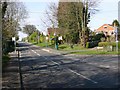
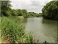
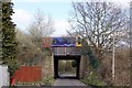
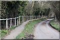
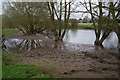
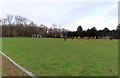
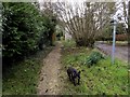
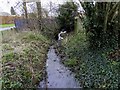
74 photos from this area
Area Information
Key information about the OX1 5RR including its size, population, and administrative classification.
- Area Type
- Postcode
- Area Size
- 3.7 hectares
- Population
- 1342
- Population Density
- 203 people/km²
House Prices in OX1 5RR
44
Properties
£368,513
Average Sold Price
£155,000
Lowest Price
£750,000
Highest Price
Showing 44 properties
| Address | Type | Beds | Baths | Last Sale Price | Last Sale Date | |
|---|---|---|---|---|---|---|
| 32 Cranbrook Drive, Kennington, Oxford, OX1 5RR | Detached | 5 | 3 | £578,000 | Nov 2025 | |
| 22 Cranbrook Drive, Kennington, Oxford, OX1 5RR | Bungalow | 3 | 1 | £465,000 | Sep 2025 | |
| 1 Cranbrook Drive, Kennington, Oxford, OX1 5RR | Detached | 6 | 4 | £750,000 | Sep 2024 | |
| 24 Cranbrook Drive, Kennington, Oxford, OX1 5RR | Bungalow | 3 | 1 | £450,000 | May 2024 | |
| 3 Cranbrook Drive, Kennington, Oxford, OX1 5RR | Detached | 4 | 1 | £470,000 | May 2024 | |
| 19 Cranbrook Drive, Kennington, Oxford, OX1 5RR | Detached | 4 | 1 | £509,910 | Jan 2022 | |
| 26 Cranbrook Drive, Kennington, Oxford, OX1 5RR | Bungalow | - | - | £410,000 | Jun 2021 | |
| 16 Cranbrook Drive, Kennington, Oxford, OX1 5RR | Detached | 3 | 1 | £365,000 | Dec 2020 | |
| 33 Cranbrook Drive, Kennington, Oxford, OX1 5RR | Detached | 4 | - | £440,000 | Apr 2018 | |
| 45 Cranbrook Drive, Kennington, Oxford, OX1 5RR | house | - | - | £380,000 | Aug 2017 |
Page 1 of 5
Energy Efficiency in OX1 5RR
Amenities
Schools
| Rank | School | Type | Entry gender | Ages |
|---|
Explore more schools in this area
Go to Schools tabDemographics
Household Size
Two person
most common
Accommodation Type
Houses
most common
Tenure
76
majority
Ethnic Group
White
most common
Religion
N/A
most common
Household Composition
N/A
most common
Age
47
median
Adults (30-64 years)
most common
Household Deprivation
N/A
with no deprivation
NS-SEC
52
in Lower managerial occupations
Explore more demographic insights in this area
Go to Demographics tabPlanning
Planning Constraints
- Flood RiskPremium
- Ramsar Wetland SitesPremium
- Area of Outstanding Natural BeautyPremium
- Protected Nature ReservePremium
- Protected WoodlandPremium