Area Overview for OX1 5JF
Photos of OX1 5JF
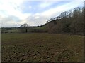
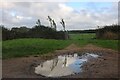
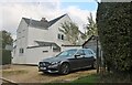
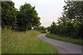
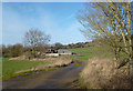
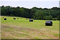
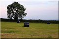
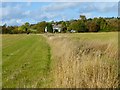
16 photos from this area
Area Information
Key information about the OX1 5JF including its size, population, and administrative classification.
- Area Type
- Postcode
- Area Size
- 23.9 hectares
- Population
- 1423
- Population Density
- 156 people/km²
House Prices in OX1 5JF
17
Properties
£1,566,500
Average Sold Price
£565,000
Lowest Price
£2,800,000
Highest Price
Showing 17 properties
| Address | Type | Beds | Baths | Last Sale Price | Last Sale Date | |
|---|---|---|---|---|---|---|
| Holly Tree House, Jarn Way, Boars Hill, Oxford, OX1 5JF | Detached | 4 | 4 | £2,800,000 | Nov 2022 | |
| Foxcombe Orchard, Jarn Way, Boars Hill, Oxford, OX1 5JF | house | 7 | - | £2,400,000 | Oct 2022 | |
| Blackthorn Lodge, Jarn Way, Boars Hill, Oxford, OX1 5JF | Detached | - | - | £1,900,000 | Nov 2021 | |
| The Gore, Jarn Way, Boars Hill, Oxford, OX1 5JF | house | 4 | - | £1,160,000 | Aug 2020 | |
| Heron Wood, Jarn Way, Boars Hill, Oxford, OX1 5JF | Detached | 3 | 3 | £1,275,000 | Jul 2018 | |
| Ripon Lodge, Jarn Way, Boars Hill, Oxford, OX1 5JF | house | - | - | £1,350,000 | Mar 2018 | |
| Pinecroft, Jarn Way, Boars Hill, Oxford, OX1 5JF | Detached | 3 | 2 | £1,750,000 | Jan 2015 | |
| Bishop Oak, Jarn Way, Boars Hill, Oxford, OX1 5JF | Detached | - | - | £1,600,000 | Aug 2007 | |
| Paddock Brow, Jarn Way, Boars Hill, Oxford, OX1 5JF | Detached | 3 | 2 | £865,000 | Jan 2004 | |
| The Lodge, Jarn Way, Boars Hill, Oxford, OX1 5JF | house | 3 | - | £565,000 | Jul 2003 |
Page 1 of 2
Energy Efficiency in OX1 5JF
Amenities
Schools
| Rank | School | Type | Entry gender | Ages |
|---|
Explore more schools in this area
Go to Schools tabDemographics
Household Size
Two person
most common
Accommodation Type
Houses
most common
Tenure
84
majority
Ethnic Group
White
most common
Religion
N/A
most common
Household Composition
N/A
most common
Age
47
median
Adults (30-64 years)
most common
Household Deprivation
N/A
with no deprivation
NS-SEC
53
in Lower managerial occupations
Explore more demographic insights in this area
Go to Demographics tabPlanning
Planning Constraints
- Flood RiskPremium
- Ramsar Wetland SitesPremium
- Area of Outstanding Natural BeautyPremium
- Protected Nature ReservePremium
- Protected WoodlandPremium