Area Overview for OX1 5DJ
Photos of OX1 5DJ

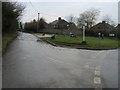
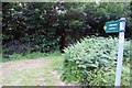
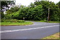
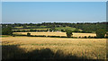
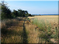
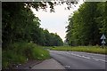
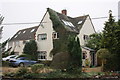
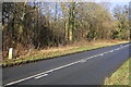
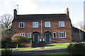
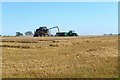
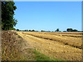
18 photos from this area
Area Information
Key information about the OX1 5DJ including its size, population, and administrative classification.
- Area Type
- Postcode
- Area Size
- 17.4 hectares
- Population
- 1423
- Population Density
- 156 people/km²
House Prices in OX1 5DJ
12
Properties
£1,507,000
Average Sold Price
£1,110,000
Lowest Price
£2,100,000
Highest Price
Showing 12 properties
| Address | Type | Beds | Baths | Last Sale Price | Last Sale Date | |
|---|---|---|---|---|---|---|
| Hill House, Hamels Lane, Boars Hill, Oxford, OX1 5DJ | house | - | - | £2,100,000 | Nov 2023 | |
| Woodsend, Hamels Lane, Boars Hill, Oxford, OX1 5DJ | Detached | - | - | £1,475,000 | Mar 2018 | |
| Broomfield, Hamels Lane, Boars Hill, Oxford, OX1 5DJ | house | - | - | £1,250,000 | Jul 2016 | |
| Melfort, Hamels Lane, Boars Hill, Oxford, OX1 5DJ | Detached | 6 | 4 | £1,600,000 | Jan 2008 | |
| White Lodge, Hamels Lane, Boars Hill, Oxford, OX1 5DJ | Detached | 5 | 3 | £1,110,000 | Apr 2004 | |
| Hamels Court, Hamels Lane, Boars Hill, Oxford, OX1 5DJ | Detached | 5 | 3 | - | - | |
| Hamels, Hamels Lane, Boars Hill, Oxford, OX1 5DJ | Detached | 6 | 6 | - | - | |
| Greenwood, Hamels Lane, Boars Hill, Oxford, OX1 5DJ | house | 3 | - | - | - | |
| Meadow Bank, Hamels Lane, Boars Hill, Oxford, OX1 5DJ | Detached | - | - | - | - | |
| Hamels Lodge, Hamels Lane, Boars Hill, Oxford, OX1 5DJ | Bungalow | - | - | - | - |
Page 1 of 2
Energy Efficiency in OX1 5DJ
Amenities
Schools
| Rank | School | Type | Entry gender | Ages |
|---|
Explore more schools in this area
Go to Schools tabDemographics
Household Size
Two person
most common
Accommodation Type
Houses
most common
Tenure
84
majority
Ethnic Group
White
most common
Religion
N/A
most common
Household Composition
N/A
most common
Age
47
median
Adults (30-64 years)
most common
Household Deprivation
N/A
with no deprivation
NS-SEC
53
in Lower managerial occupations
Explore more demographic insights in this area
Go to Demographics tabPlanning
Planning Constraints
- Flood RiskPremium
- Ramsar Wetland SitesPremium
- Area of Outstanding Natural BeautyPremium
- Protected Nature ReservePremium
- Protected WoodlandPremium