Area Overview for OX1 5BJ
Photos of OX1 5BJ
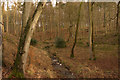
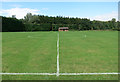
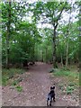
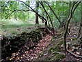

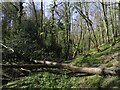
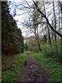
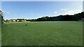
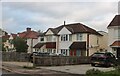
22 photos from this area
Area Information
Key information about the OX1 5BJ including its size, population, and administrative classification.
- Area Type
- Postcode
- Area Size
- 30.9 hectares
- Population
- 1342
- Population Density
- 203 people/km²
House Prices in OX1 5BJ
10
Properties
£881,500
Average Sold Price
£655,500
Lowest Price
£1,450,000
Highest Price
Showing 10 properties
| Address | Type | Beds | Baths | Last Sale Price | Last Sale Date | |
|---|---|---|---|---|---|---|
| Hazelwood, Spring Copse, Oxford, OX1 5BJ | Detached | 5 | 4 | £1,450,000 | Jul 2022 | |
| St Michaels, Spring Copse, Oxford, OX1 5BJ | house | - | - | £695,000 | Nov 2019 | |
| Brambles Spring Copse, Hinksey Hill, Oxford, OX1 5BJ | Detached | 6 | 4 | £1,100,000 | Apr 2018 | |
| Siskins, Spring Copse, Oxford, OX1 5BJ | Detached | 5 | 3 | £800,000 | Jan 2015 | |
| St Martins, Spring Copse, Oxford, OX1 5BJ | Detached | - | - | £750,000 | Nov 2005 | |
| Travellers Rest, Spring Copse, Oxford, OX1 5BJ | Detached | - | - | £655,500 | Apr 2005 | |
| Bagley Cottage, Spring Copse, Oxford, OX1 5BJ | Detached | - | - | £720,000 | Mar 2004 | |
| The Annexe, Travellers Rest, Spring Copse, Oxford, OX1 5BJ | Flat | - | - | - | - | |
| Loudon, Spring Copse, Oxford, OX1 5BJ | Detached | - | - | - | - | |
| Drake House, Spring Copse, Oxford, OX1 5BJ | Detached | - | - | - | - |
Energy Efficiency in OX1 5BJ
Amenities
Schools
| Rank | School | Type | Entry gender | Ages |
|---|
Explore more schools in this area
Go to Schools tabDemographics
Household Size
Two person
most common
Accommodation Type
Houses
most common
Tenure
76
majority
Ethnic Group
White
most common
Religion
N/A
most common
Household Composition
N/A
most common
Age
47
median
Adults (30-64 years)
most common
Household Deprivation
N/A
with no deprivation
NS-SEC
52
in Lower managerial occupations
Explore more demographic insights in this area
Go to Demographics tabPlanning
Planning Constraints
- Flood RiskPremium
- Ramsar Wetland SitesPremium
- Area of Outstanding Natural BeautyPremium
- Protected Nature ReservePremium
- Protected WoodlandPremium