Area Overview for OX1 4TQ
Photos of OX1 4TQ

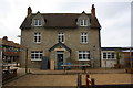
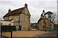
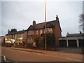
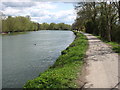
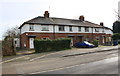
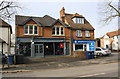
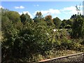
100 photos from this area
Area Information
Key information about the OX1 4TQ including its size, population, and administrative classification.
- Area Type
- Postcode
- Area Size
- 1.1 hectares
- Population
- 1811
- Population Density
- 1551 people/km²
House Prices in OX1 4TQ
28
Properties
£288,754
Average Sold Price
£54,000
Lowest Price
£430,000
Highest Price
Showing 28 properties
| Address | Type | Beds | Baths | Last Sale Price | Last Sale Date | |
|---|---|---|---|---|---|---|
| 354 Abingdon Road, Oxford, OX1 4TQ | Detached | 4 | 2 | £430,000 | Nov 2025 | |
| 352 Abingdon Road, Oxford, OX1 4TQ | Semi-detached | 4 | 2 | £430,000 | Nov 2025 | |
| 350 Abingdon Road, Oxford, OX1 4TQ | Detached | 3 | 2 | £425,000 | Apr 2025 | |
| 344 Abingdon Road, Oxford, OX1 4TQ | Semi-detached | 3 | 1 | £265,000 | Nov 2019 | |
| 342 Abingdon Road, Oxford, OX1 4TQ | Semi-detached | 3 | 1 | £340,299 | Jun 2016 | |
| 364 Abingdon Road, Oxford, OX1 4TQ | Terraced | 3 | 1 | £375,000 | Jun 2015 | |
| 368 Abingdon Road, Oxford, OX1 4TQ | Terraced | 3 | 1 | £220,000 | Aug 2008 | |
| 370 Abingdon Road, Oxford, OX1 4TQ | Terraced | 2 | 1 | £219,000 | Aug 2006 | |
| 358 Abingdon Road, Oxford, OX1 4TQ | undefined | - | - | £340,000 | Feb 1999 | |
| 376 Abingdon Road, Oxford, OX1 4TQ | Terraced | - | - | £54,000 | Mar 1996 |
Page 1 of 3
Energy Efficiency in OX1 4TQ
Amenities
Schools
| Rank | School | Type | Entry gender | Ages |
|---|
Explore more schools in this area
Go to Schools tabDemographics
Household Size
Family (3-5 people)
most common
Accommodation Type
Houses
most common
Tenure
51
majority
Ethnic Group
White
most common
Religion
N/A
most common
Household Composition
N/A
most common
Age
47
median
Adults (30-64 years)
most common
Household Deprivation
N/A
with no deprivation
NS-SEC
45
in Lower managerial occupations
Explore more demographic insights in this area
Go to Demographics tabPlanning
Planning Constraints
- Flood RiskPremium
- Ramsar Wetland SitesPremium
- Area of Outstanding Natural BeautyPremium
- Protected Nature ReservePremium
- Protected WoodlandPremium