Area Overview for OX1 4RU
Photos of OX1 4RU
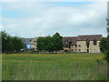
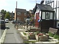

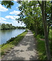

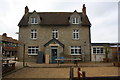
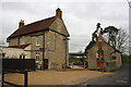
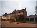
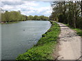
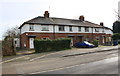
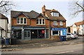
100 photos from this area
Area Information
Key information about the OX1 4RU including its size, population, and administrative classification.
- Area Type
- Postcode
- Area Size
- 3519 m²
- Population
- 1416
- Population Density
- 2241 people/km²
House Prices in OX1 4RU
25
Properties
£433,272
Average Sold Price
£119,950
Lowest Price
£658,000
Highest Price
Showing 25 properties
| Address | Type | Beds | Baths | Last Sale Price | Last Sale Date | |
|---|---|---|---|---|---|---|
| 16 Summerfield, Oxford, OX1 4RU | Terraced | 3 | 1 | £658,000 | Jun 2025 | |
| 7 Summerfield, Oxford, OX1 4RU | house | - | - | £474,000 | Mar 2025 | |
| 22 Summerfield, Oxford, OX1 4RU | Terraced | 2 | 2 | £491,000 | Sep 2024 | |
| 20 Summerfield, Oxford, OX1 4RU | Terraced | 3 | 1 | £585,000 | Mar 2024 | |
| 12 Summerfield, Oxford, OX1 4RU | Retail | 3 | 1 | £540,000 | Aug 2022 | |
| 11 Summerfield, Oxford, OX1 4RU | house | - | - | £485,000 | Feb 2021 | |
| 19 Summerfield, Oxford, OX1 4RU | Terraced | 3 | 1 | £490,000 | Jun 2018 | |
| 2 Summerfield, Oxford, OX1 4RU | Terraced | 3 | - | £560,000 | Feb 2018 | |
| 17 Summerfield, Oxford, OX1 4RU | Terraced | 3 | 1 | £535,000 | Aug 2016 | |
| 4 Summerfield, Oxford, OX1 4RU | Terraced | 3 | 1 | £500,000 | May 2016 |
Page 1 of 3
Energy Efficiency in OX1 4RU
Amenities
Schools
| Rank | School | Type | Entry gender | Ages |
|---|
Explore more schools in this area
Go to Schools tabDemographics
Household Size
Family (3-5 people)
most common
Accommodation Type
Houses
most common
Tenure
57
majority
Ethnic Group
White
most common
Religion
N/A
most common
Household Composition
N/A
most common
Age
47
median
Adults (30-64 years)
most common
Household Deprivation
N/A
with no deprivation
NS-SEC
53
in Lower managerial occupations
Explore more demographic insights in this area
Go to Demographics tabPlanning
Planning Constraints
- Flood RiskPremium
- Ramsar Wetland SitesPremium
- Area of Outstanding Natural BeautyPremium
- Protected Nature ReservePremium
- Protected WoodlandPremium