Area Overview for OX1 2JB
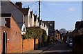
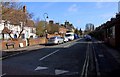
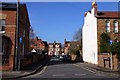
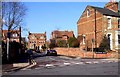
Photos of OX1 2JB


Area Information
Living in OX1 2JB means residing in a very specific residential cluster within the wider Oxford postcode sector. This small area covers a tiny population of 1,433 people, creating an intimate community feel where residents know their neighbours. You will find yourself part of a tightly knit group where daily life revolves around local interactions rather than the anonymity of a larger city district. The location is defined by its residential nature, offering quiet streets away from the busiest commercial centres of Oxford. For those who prefer a slower pace, this postcode provides a distinct alternative to the sprawling urban fabric surrounding it. The area remains distinctively small, meaning local services and events likely serve a concentrated group of households. When you walk the streets of OX1 2JB, you are in a place where the community scale is manageable and personal. This specific cluster offers a stable environment for family life or settled living without the intensity of a high-density urban zone. The character of OX1 2JB is shaped entirely by this residential focus, making it a practical choice for those prioritising a quiet, low-key address.
- Area Type
- Postcode
- Area Size
- Not available
- Population
- 1433
- Population Density
- 9293 people/km²
The property market in OX1 2JB is defined by a housing stock consisting entirely of houses. There are no flats or apartments within this specific postcode cluster, catering to those who need terrestrial living space. Only 21% of residents own their homes, while the vast majority live in rented properties. This high rental proportion indicates that the area appeals strongly to tenants who may relocate for work or family reasons rather than buyers seeking to establish permanent ownership. You are looking at a market where rental yields and tenant turnover likely play a significant role, even though the physical stock comprises traditional houses. For buyers considering homes in OX1 2JB, the low ownership rate suggests that standalone properties might command higher asking prices due to scarcity, as the supply is not competes by a large volume of for-sale stock. The area functions primarily as a rental hub within the Oxford market, attracting professionals from the science and academic sectors who value the proximity to the city while maintaining a house-based lifestyle.
House Prices in OX1 2JB
No properties found in this postcode.
Energy Efficiency in OX1 2JB
Residents of OX1 2JB benefit from a range of amenities within practical reach, including three railway stations and two airports. You can access Oxford Parkway Railway Station, Islip Railway Station, and Radley Railway Station without significant travel, facilitating easy trips into the city. London Oxford Airport and Oxford (Kidlington) Airport are also nearby, offering convenient flight connections for business or leisure. For daily shopping needs, five retail outlets serve the local community. Notable supermarkets include Sainsburys Oxford, Co-op Walton, and Co-op Little, ensuring fresh groceries and essentials are always available. These venues are positioned to meet the weekly requirements of the 1,433 residents living in the area. The transport links and retail options create a self-sufficient lifestyle where you rarely need to drive far for goods or transit. The presence of multiple rail hubs integrates the residential cluster seamlessly into the broader transport network, making commuting and weekend getaways logistically simple.
Amenities
Schools
Learners living in OX1 2JB have access to St Barnabas' Church of England Aided Primary School. This istituzione is the only primary school explicitly listed for the immediate locality. The school holds an Ofsted rating of satisfactory, which meets the government standard but does not reach the highest tiers of excellence. There are no secondary schools or academies directly named in the data for OX1 2JB, meaning families must look slightly further afield for comprehensive education. The presence of a single nearby primary school with a satisfactory rating suggests a stable but unremarkable educational offering for early years and key stage one pupils. Parents seeking extensive choice or top-rated institutions may need to broaden their search to neighbouring postcodes or rely on catchment areas for secondary education. The school landscape is simple, focused on the immediate provision of primary education without a complex network of specialisms or competing academies right on the doorstep.
| Rank | School | Type | Entry gender | Ages |
|---|
Explore more schools in this area
Go to Schools tabDemographics
The community in OX1 2JB reflects a mature population with a median age of 47 years. Most residents fall within the broad age range of 30 to 64 years, meaning the area is dominated by adults in the prime earning and family-raising decades. You will not find a young workforce influx or a large group of children or retirees dominating the local fabric. Home ownership stands at 21%, indicating that the majority of the 1,433 people live in rental accommodation rather than owning their property outright. This suggests a higher proportion of professional renters, possibly academics or workers associated with the nearby city, who prioritise flexibility over long-term ownership. The accommodation type is exclusively houses, which aligns with the preference of families and older adults who require more space. The predominant ethnic group in the area is White, reflecting a generally homogenous demographic make-up typical of established residential suburbs. Living here offers stability within a demographically consistent environment where the age profile and housing tenure remain steady over time.
Household Size
Accommodation Type
Tenure
Ethnic Group
Religion
Household Composition
Age
Household Deprivation
NS-SEC
Explore more demographic insights in this area
Go to Demographics tabPlanning
Planning Constraints
- Flood RiskPremium
- Ramsar Wetland SitesPremium
- Area of Outstanding Natural BeautyPremium
- Protected Nature ReservePremium
- Protected WoodlandPremium