Area Overview for NN13 5JU
Photos of NN13 5JU

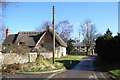
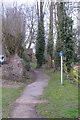
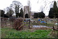
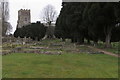
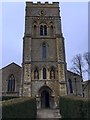

24 photos from this area
Area Information
Key information about the NN13 5JU including its size, population, and administrative classification.
- Area Type
- Postcode
- Area Size
- 25.9 hectares
- Population
- 1775
- Population Density
- 49 people/km²
House Prices in NN13 5JU
29
Properties
£421,559
Average Sold Price
£77,000
Lowest Price
£800,000
Highest Price
Showing 29 properties
| Address | Type | Beds | Baths | Last Sale Price | Last Sale Date | |
|---|---|---|---|---|---|---|
| Grooms Cottage, Main Street, Turweston, NN13 5JU | Terraced | - | - | £450,000 | May 2022 | |
| The Red Cottage, Main Street, Turweston, NN13 5JU | house | - | - | £270,000 | Nov 2021 | |
| The Old Bakehouse, Main Street, Turweston, NN13 5JU | Detached | 2 | 3 | £525,000 | Jun 2021 | |
| Old Well House, Main Street, Turweston, NN13 5JU | house | - | - | £800,000 | Mar 2021 | |
| Larch House, Main Street, Turweston, NN13 5JU | Detached | 3 | 2 | £530,000 | Feb 2021 | |
| Old Rectory, Main Street, Turweston, NN13 5JU | house | 5 | 2 | £720,000 | Jul 2018 | |
| The Paddocks, Main Street, Turweston, NN13 5JU | house | - | - | £450,000 | Nov 2016 | |
| Follywell Cottage, Main Street, Turweston, NN13 5JU | Terraced | - | - | £220,000 | Nov 2016 | |
| September Cottage, Main Street, Turweston, NN13 5JU | Semi-detached | 3 | 1 | £357,500 | Dec 2015 | |
| Kirkstones, Main Street, Turweston, NN13 5JU | Bungalow | 4 | 2 | £450,000 | Oct 2014 |
Page 1 of 3
Energy Efficiency in NN13 5JU
Amenities
Schools
| Rank | School | Type | Entry gender | Ages |
|---|
Explore more schools in this area
Go to Schools tabDemographics
Household Size
Two person
most common
Accommodation Type
Houses
most common
Tenure
74
majority
Ethnic Group
White
most common
Religion
N/A
most common
Household Composition
N/A
most common
Age
47
median
Adults (30-64 years)
most common
Household Deprivation
N/A
with no deprivation
NS-SEC
43
in Lower managerial occupations
Explore more demographic insights in this area
Go to Demographics tabPlanning
Planning Constraints
- Flood RiskPremium
- Ramsar Wetland SitesPremium
- Area of Outstanding Natural BeautyPremium
- Protected Nature ReservePremium
- Protected WoodlandPremium