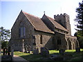
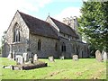
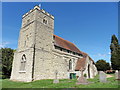
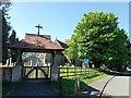
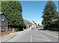
Area Overview for Mursley
Photos of Mursley


Area Information
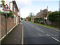
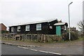
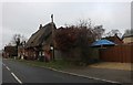
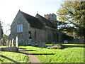
Living in Mursley means settling within a built-up area that spans just 36.2 hectares. This concentration defines a tightly knit locality rather than a sprawling suburban development. You will find yourself in a settled community where daily life revolves around proximity and established routines. The location sits comfortably within the wider Buckinghamshire landscape, offering residents a balance of local convenience and access to broader transport links. Because the area is compact, your journey to essential services often involves short trips rather than long commutes. The character of Mursley is shaped by its history as an established settlement. Residents here typically value stability and know their neighbours well. The small footprint of the built-up area implies thatdistance between your home and local amenities is manageable. This layout supports a lifestyle where you can walk or drive quickly to shops, schools, and transport hubs. It is a place where life moves at a measured pace, with the physical environment fostering a sense of enclosure and community belonging. You are not on the edge of a major city, yet you are within reach of the Hinterland shopping district and the main rail corridor that runs through Milton Keynes. The area presents itself as a quiet, residential haven for those who appreciate a defined, non-metropolitan living environment.
- Area Type
- Built Up Area 250
- Area Size
- 36.2 hectares
- Population
- Not available
- Population Density
- Not available
Daily life in Mursley is supported by five retail outlets and four railway stations within practical reach. The retail offerings are anchored by Co-op Winslow, Co-op Milton, and Co-op Bletchley, providing essential shopping needs without requiring travel to a major town centre. Placing your groceries at one of these Co-op branches ensures you can access fresh food and daily necessities with minimal effort. The presence of these three specific branches creates a convenient local circle of commerce that supports your household and household composition needs. Beyond shopping, the rail network serves as a vital artery for leaving the built-up area. You can access Bletchley, Fenny Stratford, and Milton Keynes Central Railway Station for broader regional travel. This connectivity allows daily commuters to reach major employment hubs or destinations beyond Buckinghamshire. The area's lifestyle is defined by this practical proximity: you can handle your local shopping needs locally and handle your longer journeys via an adjacent rail corridor. While the area lacks a high-street entertainment district within its 36.2 hectares, the accessible amenities provide a straightforward and efficient routine for living in Mursley.
Amenities
Schools
The educational landscape near Mursley is centred on one primary educational facility. Mursley Church of England School serves as the main institution for primary education in the vicinity. This school holds a "good" Ofsted rating, a designation that signifies consistent standards and effective teaching practices. The absence of secondary schools listed in the immediate neighbourhood data suggests that secondary education for children in Mursley requires travel to neighbouring towns or boroughs. The presence of a single primary school with a positive rating indicates that families with young children have access to a stable, high-standard local institution. The school's religious affiliation as "Church of England" provides a definition of character and ethos for parents seeking faith-based education. While the data does not detail the number of pupils or specific headteacher achievements, the "good" rating confirms the school meets the required benchmarks for quality. Families requiring secondary education must look beyond the immediate 36.2 hectares of Mursley to find appropriate colleges. The local provision is solid for early years but relies on external transport or walking distances for older students.
| Rank | School | Type | Entry gender | Ages |
|---|
Explore more schools in this area
Go to Schools tabDemographics
The community in Mursley has a distinct demographic profile, anchored by a high level of stability. The median age for residents is 70, indicating that the population skews significantly older than the national average. This age structure suggests a neighbourhood where long-term residents prevail. When you consider home ownership levels at 79%, it becomes clear that most people in Mursley have a strong financial stake in their local environment. This high rate of owner occupancy contrasts sharply with typical private rental markets found elsewhere. The absence of specific data regarding household composition or predominant ethnic group in the current records means we cannot speculate on minor variations. However, the overwhelming evidence points to a community defined by retirement or semi-retired living. The most common age range listed categorically as "Age: Total" reinforces the idea that demographic breakdowns in this area are not granular in public records, yet the median age provides a definitive picture. The lack of young families or transient populations is further supported by the dominance of older age cohorts. Consequently, the social fabric is likely built on quiet contemplation and established local networks rather than the rapid turnover associated with growing cities. The area caters to a specific slice of society who have already achieved significant life milestones.
Household Size
Accommodation Type
Tenure
Ethnic Group
Religion
Household Composition
Age
Household Deprivation
NS-SEC
Explore more demographic insights in this area
Go to Demographics tabPlanning
Planning Constraints
- Crime RiskPremium