Area Overview for MK9 2DT
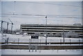
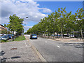
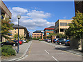
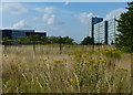
Photos of MK9 2DT


Area Information
Living in MK9 2DT offers a compact residential experience within a small cluster of homes. The area covers just 1.2 hectares, housing 1,470 people at a density of 1,116 per square kilometre. This makes it a tightly knit community, ideal for those seeking proximity to amenities without sprawling urban sprawl. The postcode is served by key infrastructure, including five retail outlets such as M&S Milton and Sainsburys Milton, and five rail stations, including Milton Keynes Central Railway Station. Daily life here balances convenience with a quieter, more contained environment. The area’s demographics suggest a mature population, with adults aged 30–64 forming the majority. While the high population density may feel intimate, it also means limited space for expansion. For buyers, MK9 2DT’s small size and focused layout present a unique opportunity to own a home in a well-connected yet low-key setting.
- Area Type
- Postcode
- Area Size
- 1.2 hectares
- Population
- 1470
- Population Density
- 1116 people/km²
The property market in MK9 2DT is characterised by a low home ownership rate of 25%, meaning the majority of properties are rented rather than owned. This suggests a rental-focused market, potentially appealing to investors or those seeking short-term housing solutions. The accommodation type is predominantly flats, which aligns with the area’s compact size and high population density. For buyers, this presents a challenge: the small footprint of MK9 2DT limits the availability of owner-occupied homes, and the housing stock is unlikely to expand significantly. Prospective buyers should consider the implications of purchasing in a rental-heavy area, where demand may be driven by transient populations rather than long-term residency. The limited number of properties also means competition for available homes, particularly for those seeking larger or more traditional housing types.
House Prices in MK9 2DT
No properties found in this postcode.
Energy Efficiency in MK9 2DT
MK9 2DT offers a mix of retail and transport amenities within practical reach. The area includes five retail outlets, such as M&S Milton and Sainsburys Milton, providing everyday shopping needs. These stores cater to both routine purchases and larger grocery shopping, supporting a self-contained lifestyle. The presence of multiple rail stations, including Bletchley Railway Station, ensures easy access to regional hubs, enhancing mobility for commuters and visitors. While the area is small, its proximity to these amenities means residents can access essential services without long journeys. The combination of retail options and transport links contributes to a convenient, if compact, lifestyle, ideal for those valuing accessibility over expansive local facilities.
Amenities
Schools
Residents of MK9 2DT have access to two independent schools: Citischool and iPEC. Both are fee-paying institutions, offering alternative educational options for families seeking non-state-run schooling. Independent schools often provide smaller class sizes and specialised curricula, which may appeal to parents prioritising tailored education. However, the absence of state school data means it is unclear whether local state options are available or how they compare in quality. For families relying on public education, the proximity of these independent schools could influence their decision to settle in the area. The mix of school types suggests a community that values educational choice, though buyers should investigate further to understand the full range of options for children of all ages.
| Rank | School | Type | Entry gender | Ages |
|---|
Explore more schools in this area
Go to Schools tabDemographics
The community in MK9 2DT is predominantly composed of adults aged 30–64, with a median age of 47. This suggests a stable, established population, likely with long-term ties to the area. Home ownership is relatively low at 25%, indicating that most residents rent their homes. The accommodation type is primarily flats, reflecting a housing stock tailored to smaller households or those prioritising convenience over space. The predominant ethnic group is White, though specific data on diversity is not provided. With a population density of 1,116 per square kilometre, the area is densely populated, which may influence local services and community dynamics. For buyers, this profile suggests a market skewed towards rental properties, with limited opportunities for owner-occupation. The age range also implies a demand for amenities catering to middle-aged residents, such as reliable transport and accessible services.
Household Size
Accommodation Type
Tenure
Ethnic Group
Religion
Household Composition
Age
Household Deprivation
NS-SEC
Explore more demographic insights in this area
Go to Demographics tabPlanning
Planning Constraints
- Flood RiskPremium
- Ramsar Wetland SitesPremium
- Area of Outstanding Natural BeautyPremium
- Protected Nature ReservePremium
- Protected WoodlandPremium