Area Overview for MK9 1NB
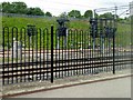
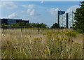
Photos of MK9 1NB


Area Information
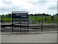
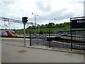
Living in MK9 1NB means being part of a tightly knit residential cluster in Milton Keynes, where a population of 1,470 people lives at a density of 1,116 per square kilometre. This small postcode area is characterised by a mature demographic, with residents predominantly aged 30–64 and a median age of 47. The community is largely composed of renters, with only 25% of homes owned outright, and most properties are flats. Despite its compact size, the area offers practical access to essential services, including five nearby rail stations such as Milton Keynes Central and Wolverton, which connect residents to broader regional networks. Nearby, retail outlets like Sainsburys Milton and Morrisons provide daily convenience. For families, two independent schools—Citischool and iPEC—are within reach, though their fee-based model may influence educational choices. The area’s compact nature means daily life is efficiently scaled, with amenities and transport options within close proximity, making it a practical choice for those prioritising accessibility over expansive space.
- Area Type
- Postcode
- Area Size
- Not available
- Population
- 1470
- Population Density
- 1116 people/km²
MK9 1NB’s property market is defined by a low home ownership rate—only 25% of residents own their homes—which suggests a rental market rather than an owner-occupied one. The accommodation type is predominantly flats, aligning with the area’s high population density and compact layout. This configuration is typical for urban or semi-urban settings where space is limited, and housing is designed for efficiency. For buyers, the small size of the postcode area means the housing stock is concentrated, with limited scope for expansion or development. The focus on flats may appeal to those seeking manageable, low-maintenance properties, but the rental-heavy market could affect long-term investment potential. Prospective buyers should consider the area’s practicality for those prioritising proximity to transport and amenities over larger living spaces.
House Prices in MK9 1NB
No properties found in this postcode.
Energy Efficiency in MK9 1NB
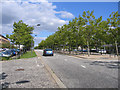
The lifestyle in MK9 1NB is shaped by its proximity to retail and transport hubs. Nearby, Aldi The, Sainsburys Milton, and Morrisons Milton provide essential shopping, while the five rail stations—such as Bletchley and Wolverton—offer seamless travel to Milton Keynes and beyond. Though the area lacks extensive green spaces or leisure facilities, its compact design ensures daily needs are met without long commutes. The presence of independent schools and rail links suggests a focus on practicality and accessibility. For residents, the area’s convenience is its defining feature: essential services are within walking or short driving distance, and the rail network connects to broader opportunities. While the lack of expansive parks or cultural venues may limit recreational options, the emphasis on efficiency makes MK9 1NB ideal for those prioritising functional living over leisure-centric environments.
Amenities
Schools
Residents of MK9 1NB have access to two independent schools: Citischool and iPEC. Both are fee-paying institutions, which may be a factor for families considering educational options. Independent schools often offer smaller class sizes and specialised curricula, but the financial commitment required for enrollment is significant. The absence of state schools in the immediate vicinity means families must weigh the cost of private education against the benefits. For those prioritising academic or extracurricular opportunities, these schools provide alternatives, though they do not cater to all budget ranges. The proximity of these institutions to the area underscores its appeal for families seeking structured educational environments, though the lack of state options may limit accessibility for some.
| Rank | School | Type | Entry gender | Ages |
|---|
Explore more schools in this area
Go to Schools tabDemographics
The population of MK9 1NB is predominantly adults aged 30–64, with a median age of 47, reflecting a mature, stable community. Only 25% of residents own their homes, suggesting a rental-dominated market, and the majority live in flats, which is typical for urban areas. The predominant ethnic group is White, with no specific data on other demographics provided. This age profile indicates a population likely focused on long-term stability, possibly with a significant proportion of professionals or retired individuals. The relatively low home ownership rate may imply a transient element, though the area’s compact size fosters a sense of familiarity. For quality of life, the absence of specific deprivation data means it is challenging to assess economic challenges, but the presence of independent schools and rail links suggests infrastructure that supports daily needs.
Household Size
Accommodation Type
Tenure
Ethnic Group
Religion
Household Composition
Age
Household Deprivation
NS-SEC
Explore more demographic insights in this area
Go to Demographics tabPlanning
Planning Constraints
- Flood RiskPremium
- Ramsar Wetland SitesPremium
- Area of Outstanding Natural BeautyPremium
- Protected Nature ReservePremium
- Protected WoodlandPremium