Area Overview for MK8 9BX
Photos of MK8 9BX


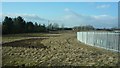
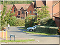
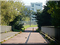
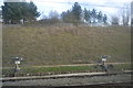


54 photos from this area
Area Information
Key information about the MK8 9BX including its size, population, and administrative classification.
- Area Type
- Postcode
- Area Size
- 1.4 hectares
- Population
- 1389
- Population Density
- 3734 people/km²
House Prices in MK8 9BX
28
Properties
£264,113
Average Sold Price
£49,000
Lowest Price
£665,000
Highest Price
Showing 28 properties
| Address | Type | Beds | Baths | Last Sale Price | Last Sale Date | |
|---|---|---|---|---|---|---|
| 16 Attingham Hill, Great Holm, Milton Keynes, MK8 9BX | Semi-detached | 2 | 1 | £280,000 | May 2024 | |
| 22 Attingham Hill, Great Holm, Milton Keynes, MK8 9BX | Semi-detached | 3 | 1 | £360,000 | Dec 2021 | |
| 12 Attingham Hill, Great Holm, Milton Keynes, MK8 9BX | Semi-detached | 2 | 1 | £275,000 | Nov 2021 | |
| 2 Attingham Hill, Great Holm, Milton Keynes, MK8 9BX | house | 3 | 1 | £315,000 | Jan 2019 | |
| 42 Attingham Hill, Great Holm, Milton Keynes, MK8 9BX | Detached | 4 | 3 | £500,000 | Nov 2018 | |
| 18 Attingham Hill, Great Holm, Milton Keynes, MK8 9BX | Detached | 3 | 1 | £312,000 | Jun 2018 | |
| 4 Attingham Hill, Great Holm, Milton Keynes, MK8 9BX | Semi-detached | 3 | 2 | £162,500 | Jan 2018 | |
| 20 Attingham Hill, Great Holm, Milton Keynes, MK8 9BX | Semi-detached | 3 | 2 | £315,000 | May 2016 | |
| 48 Attingham Hill, Great Holm, Milton Keynes, MK8 9BX | Detached | 5 | - | £665,000 | Jan 2016 | |
| 36 Attingham Hill, Great Holm, Milton Keynes, MK8 9BX | Semi-detached | 3 | 1 | £290,000 | Oct 2015 |
Page 1 of 3
Energy Efficiency in MK8 9BX
Amenities
Schools
| Rank | School | Type | Entry gender | Ages |
|---|
Explore more schools in this area
Go to Schools tabDemographics
Household Size
Family (3-5 people)
most common
Accommodation Type
Houses
most common
Tenure
79
majority
Ethnic Group
White
most common
Religion
N/A
most common
Household Composition
N/A
most common
Age
47
median
Adults (30-64 years)
most common
Household Deprivation
N/A
with no deprivation
NS-SEC
48
in Lower managerial occupations
Explore more demographic insights in this area
Go to Demographics tabPlanning
Planning Constraints
- Flood RiskPremium
- Ramsar Wetland SitesPremium
- Area of Outstanding Natural BeautyPremium
- Protected Nature ReservePremium
- Protected WoodlandPremium