Area Overview for MK8 8YZ
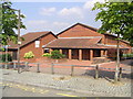
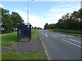
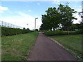
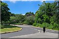
Photos of MK8 8YZ


Area Information
MK8 8YZ is a small, tightly knit residential postcode in England, home to 1,386 people spread across a compact area with a population density of 1,134 people per square kilometre. This suggests a closely populated, perhaps even semi-rural cluster of homes, typical of smaller postcode areas. The community here is predominantly composed of adults aged 30 to 64, with a median age of 47, indicating a mature, stable demographic. Daily life in MK8 8YZ is likely characterised by a mix of local retail and transport hubs, with nearby amenities such as supermarkets and railway stations within practical reach. The area’s proximity to Milton Keynes Central Railway Station and Wolverton Railway Station offers easy access to regional travel, while shops like M&S Bradwell Abbey and Tesco Greenleys provide convenience for residents. The high broadband score of 99 and a mobile coverage score of 85 ensure reliable digital connectivity, supporting both work and leisure activities. For those considering living here, MK8 8YZ offers a blend of residential tranquillity and practical accessibility, though its small size means it is best suited for those prioritising proximity to services over expansive space.
- Area Type
- Postcode
- Area Size
- Not available
- Population
- 1386
- Population Density
- 1134 people/km²
MK8 8YZ is a small area where 45% of residents own their homes, with houses making up the majority of the accommodation type. This suggests a market skewed towards owner-occupation rather than rental properties, though the exact number of rental units is not specified. The prevalence of houses may indicate a focus on traditional, possibly larger properties, which could appeal to families or individuals seeking more space. Given the area’s size, the housing stock is likely limited, making it a niche market for buyers seeking specific properties. Proximity to rail stations such as Milton Keynes Central and Wolverton may enhance the area’s appeal for commuters, though the small postcode means buyers should consider nearby neighbourhoods for broader options. The combination of home ownership and house-centric development positions MK8 8YZ as a stable but modestly sized residential market.
House Prices in MK8 8YZ
No properties found in this postcode.
Energy Efficiency in MK8 8YZ
Living in MK8 8YZ offers access to a range of nearby amenities, including five retail outlets such as M&S Bradwell Abbey, Tesco Greenleys, and Morrisons Daily Milton, ensuring convenience for shopping and daily necessities. The area’s rail network is well-connected, with stations like Milton Keynes Central, Wolverton, and Bletchley providing regular services to nearby towns and cities. While the postcode itself is small, the presence of these amenities suggests a lifestyle that balances local convenience with regional accessibility. The retail options cater to both casual shopping and essential needs, while the rail links support commuting or weekend travel. Though the area lacks detailed information on parks or leisure facilities, the existing infrastructure implies a practical, service-oriented lifestyle. For residents, the combination of retail and transport options makes MK8 8YZ a functional choice for those valuing proximity to services.
Amenities
Schools
| Rank | School | Type | Entry gender | Ages |
|---|
Explore more schools in this area
Go to Schools tabDemographics
The population of MK8 8YZ is predominantly adults aged 30 to 64, with a median age of 47, reflecting a community of established professionals and families. Home ownership stands at 45%, suggesting a mix of owner-occupied properties and rental units, though the exact proportion of renters is not specified. The area is composed mainly of houses, which may indicate a preference for detached or semi-detached homes over flats. The predominant ethnic group is White, though no further breakdown of diversity is provided. With a population density of 1,134 people per square kilometre, the area is moderately crowded but not overly dense. The demographic profile suggests a community focused on stability and long-term living, with fewer young families or elderly residents compared to other areas. This balance may influence local amenities and services, which are tailored to the needs of middle-aged residents.
Household Size
Accommodation Type
Tenure
Ethnic Group
Religion
Household Composition
Age
Household Deprivation
NS-SEC
Explore more demographic insights in this area
Go to Demographics tabPlanning
Planning Constraints
- Flood RiskPremium
- Ramsar Wetland SitesPremium
- Area of Outstanding Natural BeautyPremium
- Protected Nature ReservePremium
- Protected WoodlandPremium