Area Overview for MK8 8EL
Photos of MK8 8EL
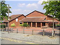


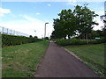


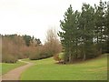
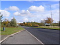

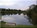
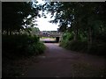
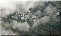
13 photos from this area
Area Information
Key information about the MK8 8EL including its size, population, and administrative classification.
- Area Type
- Postcode
- Area Size
- 5404 m²
- Population
- 1301
- Population Density
- 4736 people/km²
House Prices in MK8 8EL
11
Properties
£303,643
Average Sold Price
£74,500
Lowest Price
£507,000
Highest Price
Showing 11 properties
| Address | Type | Beds | Baths | Last Sale Price | Last Sale Date | |
|---|---|---|---|---|---|---|
| 35 Astlethorpe, Two Mile Ash, Milton Keynes, MK8 8EL | house | - | - | £507,000 | Nov 2021 | |
| 15 Astlethorpe, Two Mile Ash, Milton Keynes, MK8 8EL | Detached | 4 | 1 | £402,000 | Apr 2019 | |
| 19 Astlethorpe, Two Mile Ash, Milton Keynes, MK8 8EL | Detached | 4 | 2 | £410,000 | Jan 2019 | |
| 25 Astlethorpe, Two Mile Ash, Milton Keynes, MK8 8EL | house | - | - | £245,000 | Dec 2011 | |
| 23 Astlethorpe, Two Mile Ash, Milton Keynes, MK8 8EL | Detached | 4 | 2 | £229,000 | Jan 2007 | |
| 27 Astlethorpe, Two Mile Ash, Milton Keynes, MK8 8EL | Detached | - | - | £258,000 | Sep 2004 | |
| 33 Astlethorpe, Two Mile Ash, Milton Keynes, MK8 8EL | Detached | - | - | £74,500 | Sep 1995 | |
| 21 Astlethorpe, Two Mile Ash, Milton Keynes, MK8 8EL | Detached | - | - | - | - | |
| 29 Astlethorpe, Two Mile Ash, Milton Keynes, MK8 8EL | Detached | - | - | - | - | |
| 17 Astlethorpe, Two Mile Ash, Milton Keynes, MK8 8EL | Terraced | - | - | - | - |
Page 1 of 2
Energy Efficiency in MK8 8EL
Amenities
Schools
| Rank | School | Type | Entry gender | Ages |
|---|
Explore more schools in this area
Go to Schools tabDemographics
Household Size
Family (3-5 people)
most common
Accommodation Type
Houses
most common
Tenure
71
majority
Ethnic Group
White
most common
Religion
N/A
most common
Household Composition
N/A
most common
Age
47
median
Adults (30-64 years)
most common
Household Deprivation
N/A
with no deprivation
NS-SEC
38
in Lower managerial occupations
Explore more demographic insights in this area
Go to Demographics tabPlanning
Planning Constraints
- Flood RiskPremium
- Ramsar Wetland SitesPremium
- Area of Outstanding Natural BeautyPremium
- Protected Nature ReservePremium
- Protected WoodlandPremium