Area Overview for MK7 8PG
Photos of MK7 8PG


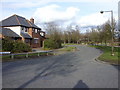
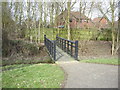
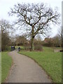
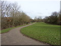
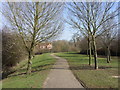


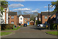

25 photos from this area
Area Information
Key information about the MK7 8PG including its size, population, and administrative classification.
- Area Type
- Postcode
- Area Size
- 2.0 hectares
- Population
- 1426
- Population Density
- 3405 people/km²
House Prices in MK7 8PG
25
Properties
£262,304
Average Sold Price
£38,000
Lowest Price
£680,000
Highest Price
Showing 25 properties
| Address | Type | Beds | Baths | Last Sale Price | Last Sale Date | |
|---|---|---|---|---|---|---|
| 15 Boyce Crescent, Old Farm Park, Milton Keynes, MK7 8PG | house | 5 | 2 | £680,000 | Sep 2024 | |
| 29 Boyce Crescent, Old Farm Park, Milton Keynes, MK7 8PG | Detached | 4 | 3 | £555,000 | Nov 2023 | |
| 17 Boyce Crescent, Old Farm Park, Milton Keynes, MK7 8PG | Detached | 4 | 2 | £585,000 | Mar 2020 | |
| 43 Boyce Crescent, Old Farm Park, Milton Keynes, MK7 8PG | Detached | 4 | - | £360,000 | Jul 2014 | |
| 1 Boyce Crescent, Old Farm Park, Milton Keynes, MK7 8PG | Detached | 4 | - | £337,500 | Jan 2013 | |
| 11 Boyce Crescent, Old Farm Park, Milton Keynes, MK7 8PG | house | - | - | £305,000 | Jul 2009 | |
| 41 Boyce Crescent, Old Farm Park, Milton Keynes, MK7 8PG | Detached | - | - | £294,000 | Mar 2006 | |
| 47 Boyce Crescent, Old Farm Park, Milton Keynes, MK7 8PG | Detached | 4 | - | £294,000 | Feb 2006 | |
| 51 Boyce Crescent, Old Farm Park, Milton Keynes, MK7 8PG | Detached | - | - | £300,000 | Aug 2004 | |
| 3 Boyce Crescent, Old Farm Park, Milton Keynes, MK7 8PG | Detached | - | - | £215,000 | Jul 2002 |
Page 1 of 3
Energy Efficiency in MK7 8PG
Amenities
Schools
| Rank | School | Type | Entry gender | Ages |
|---|
Explore more schools in this area
Go to Schools tabDemographics
Household Size
Family (3-5 people)
most common
Accommodation Type
Houses
most common
Tenure
86
majority
Ethnic Group
White
most common
Religion
N/A
most common
Household Composition
N/A
most common
Age
47
median
Adults (30-64 years)
most common
Household Deprivation
N/A
with no deprivation
NS-SEC
51
in Lower managerial occupations
Explore more demographic insights in this area
Go to Demographics tabPlanning
Planning Constraints
- Flood RiskPremium
- Ramsar Wetland SitesPremium
- Area of Outstanding Natural BeautyPremium
- Protected Nature ReservePremium
- Protected WoodlandPremium