Area Overview for MK7 8JF
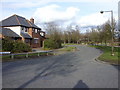
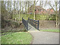
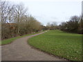
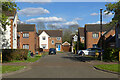
Photos of MK7 8JF


Area Information
Living in MK7 8JF offers a quiet, residential lifestyle within a small cluster of homes. With a population of 1,645, this area is compact yet well-served by essential amenities. The community feels settled, with a median age of 47 and a strong presence of adults aged 30–64. Daily life is shaped by proximity to local shops, rail links, and a primary school, making it practical for families and commuters. The area’s small size fosters a close-knit environment, though its limited scale means it is best suited for those prioritising convenience over sprawling urban or rural settings. Residents benefit from excellent broadband connectivity, rated 100 out of 100, ensuring seamless online access for work or leisure. While the area lacks major landmarks, its charm lies in its simplicity: a place where homes are predominantly owner-occupied, and the pace of life remains unhurried. For those seeking a balance between accessibility and tranquillity, MK7 8JF provides a straightforward, functional living experience.
- Area Type
- Postcode
- Area Size
- Not available
- Population
- 1645
- Population Density
- 4148 people/km²
MK7 8JF is primarily an owner-occupied area, with 61% of homes owned by residents rather than rented. This reflects a community of long-term residents, many of whom are likely to have purchased their properties as primary residences. The accommodation type is predominantly houses, which are more common than flats or apartments in this postcode. This suggests a housing stock tailored to families or individuals seeking space and privacy. The small size of the area means the property market is limited in scope, with fewer options for buyers compared to larger towns or cities. However, the high home ownership rate and focus on houses indicate a stable market with potential for long-term value retention. For buyers, this area may appeal to those prioritising a settled, low-maintenance lifestyle over a rental-focused or high-turnover environment. The proximity to rail links and retail amenities also adds practicality for those seeking a balance between residential comfort and connectivity.
House Prices in MK7 8JF
No properties found in this postcode.
Energy Efficiency in MK7 8JF
Residents of MK7 8JF have access to a range of nearby amenities, including five retail outlets such as Tesco Milton Keynes Old, Tesco Walnut, and The Southern Co-operative Co. These shops provide essential shopping options for daily needs, from groceries to household items. The area’s proximity to five railway stations ensures easy access to public transport, supporting both commuting and leisure travel. Cranfield Airport, though not a major hub, adds flexibility for those requiring flight connections. While the data does not specify parks or leisure facilities, the presence of retail and transport options suggests a practical, functional lifestyle. The area’s compact nature means amenities are concentrated, reducing the need for long journeys. For residents, this translates to a lifestyle where essentials are within reach, though the lack of detailed information on green spaces or recreational facilities leaves room for further exploration of local offerings.
Amenities
Schools
The nearest school to MK7 8JF is Wavendon Gate School, a primary school with an Ofsted rating of ‘good’. This provides a reliable educational option for families with young children, though the absence of secondary schools in the immediate vicinity may require commuting to nearby towns. The presence of a primary school with a positive rating suggests a focus on early education and community-based learning. However, the data does not include information on other schools, such as secondary or specialist institutions, which could impact the appeal for families requiring a full range of educational facilities. The single listed school indicates that the area is well-suited for those with younger children but may necessitate additional planning for older students. For prospective homebuyers, the quality of Wavendon Gate School is a key consideration, particularly for those prioritising proximity to educational institutions.
| Rank | School | Type | Entry gender | Ages |
|---|
Explore more schools in this area
Go to Schools tabDemographics
The community in MK7 8JF is predominantly composed of adults aged 30–64, with a median age of 47. This suggests a mature, stable population, likely with established careers and families. Home ownership is strong, with 61% of residents owning their homes, indicating a long-term commitment to the area. The accommodation type is primarily houses, reflecting a preference for single-family dwellings over flats or apartments. The predominant ethnic group is White, though specific data on diversity or deprivation is not provided. The absence of detailed diversity metrics means the area’s social composition remains largely uncharacterised in this regard. The age profile and home ownership rates suggest a community focused on stability and continuity, with fewer young families or transient populations. This demographic profile aligns with a low-risk environment for property investment, though it may limit the appeal for those seeking more dynamic or multicultural settings.
Household Size
Accommodation Type
Tenure
Ethnic Group
Religion
Household Composition
Age
Household Deprivation
NS-SEC
Explore more demographic insights in this area
Go to Demographics tabPlanning
Planning Constraints
- Flood RiskPremium
- Ramsar Wetland SitesPremium
- Area of Outstanding Natural BeautyPremium
- Protected Nature ReservePremium
- Protected WoodlandPremium