Area Overview for MK7 8HU
Photos of MK7 8HU


Area Information
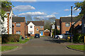
MK7 8HU is a small residential postcode area in England, home to 1,645 residents. It is a compact cluster of properties, typically houses, catering to a community with a median age of 47. The area’s character is defined by its modest scale and proximity to nearby towns, offering a balance between local living and access to broader services. Daily life here is shaped by the presence of nearby rail stations, such as Woburn Sands and Bow Brickhill, which connect residents to Milton Keynes and surrounding regions. The area’s population is predominantly White, with a strong focus on home ownership—61% of residents live in their own homes. This suggests a stable, established community, though the small size means the area is best suited for those prioritising a quieter, less densely populated lifestyle. While there are no major landmarks or commercial hubs within MK7 8HU itself, its location near retail centres like Tesco Milton Keynes Old and Cranfield Airport provides practical convenience. The area’s appeal lies in its simplicity: a place where families and older residents can live without the pressures of urban density, supported by basic amenities and reliable transport links.
- Area Type
- Postcode
- Area Size
- Not available
- Population
- 1645
- Population Density
- 4148 people/km²
MK7 8HU is predominantly a home-ownership area, with 61% of residents living in their own properties. The accommodation type is primarily houses, which suggests a focus on family-sized homes rather than apartments or flats. This housing stock is typical of smaller, semi-rural postcode areas, where larger properties are more common. The area’s limited size means the property market is constrained to a small number of available homes, which could make it challenging for buyers seeking a wide selection. However, the high home ownership rate indicates a stable market with long-term residents. For those considering purchase, the presence of nearby rail stations and retail amenities may enhance the area’s appeal, though buyers should be mindful of the limited local infrastructure. The absence of rental data means it is unclear whether the area also attracts tenants, but the emphasis on owner-occupied properties suggests it is more suited to those seeking a permanent, low-maintenance home.
House Prices in MK7 8HU
No properties found in this postcode.
Energy Efficiency in MK7 8HU
Residents of MK7 8HU have access to a range of nearby amenities, including five retail outlets such as Tesco Milton Keynes Old, Tesco Walnut, and The Southern Co-operative Co. These shops provide essential services for daily needs, from groceries to general goods. The area’s rail stations—Woburn Sands, Bow Brickhill, and Aspley Guise—offer convenient links to larger towns and cities, facilitating both commuting and weekend excursions. Cranfield Airport is also within reach, adding to the area’s connectivity. While there are no specific parks or leisure facilities listed within MK7 8HU itself, the nearby towns likely offer recreational options. The combination of retail, transport, and regional access ensures a practical lifestyle, though the area’s small size means residents must rely on nearby towns for more extensive amenities.
Amenities
Schools
The nearest school to MK7 8HU is Wavendon Gate School, a primary school with a ‘good’ Ofsted rating. This school serves the local community, providing education for younger children in the area. The absence of secondary schools within the postcode means families may need to look further afield for secondary education, though nearby towns like Milton Keynes offer a range of options. The presence of a well-rated primary school is a positive factor for families prioritising quality education, though the limited school infrastructure within MK7 8HU itself means additional planning is required for secondary schooling. This dynamic is common in smaller postcode areas, where local amenities are minimal but regional services are accessible via transport links.
| Rank | School | Type | Entry gender | Ages |
|---|
Explore more schools in this area
Go to Schools tabDemographics
The population of MK7 8HU is 1,645, with a median age of 47, indicating a community skewed toward middle-aged and older adults. The most common age range is 30-64 years, suggesting a mix of working-age individuals and retirees. Home ownership is high at 61%, reflecting a stable housing market where most residents live in their own properties. The predominant accommodation type is houses, which aligns with the area’s small, residential character. The predominant ethnic group is White, though no data is provided on other ethnicities or diversity metrics. This demographic profile implies a community with established roots, where families and older residents coexist. The lack of specific data on deprivation or socioeconomic diversity means the area’s quality of life is best inferred from its infrastructure and amenities. With rail stations and retail outlets nearby, residents benefit from accessible services, though the area’s small size limits the range of local facilities.
Household Size
Accommodation Type
Tenure
Ethnic Group
Religion
Household Composition
Age
Household Deprivation
NS-SEC
Explore more demographic insights in this area
Go to Demographics tabPlanning
Planning Constraints
- Flood RiskPremium
- Ramsar Wetland SitesPremium
- Area of Outstanding Natural BeautyPremium
- Protected Nature ReservePremium
- Protected WoodlandPremium