Area Overview for MK7 8EY
Photos of MK7 8EY


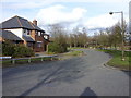
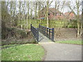
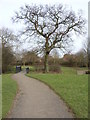
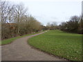
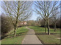


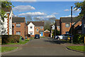

25 photos from this area
Area Information
Key information about the MK7 8EY including its size, population, and administrative classification.
- Area Type
- Postcode
- Area Size
- 7.1 hectares
- Population
- 1426
- Population Density
- 3405 people/km²
House Prices in MK7 8EY
33
Properties
£447,998
Average Sold Price
£189,950
Lowest Price
£790,000
Highest Price
Showing 33 properties
| Address | Type | Beds | Baths | Last Sale Price | Last Sale Date | |
|---|---|---|---|---|---|---|
| 15 Ravel Close, Old Farm Park, Milton Keynes, MK7 8EY | Detached | 5 | 3 | £790,000 | Aug 2025 | |
| 28 Ravel Close, Old Farm Park, Milton Keynes, MK7 8EY | Detached | 4 | 3 | £682,500 | Mar 2023 | |
| 10 Ravel Close, Old Farm Park, Milton Keynes, MK7 8EY | house | - | - | £770,000 | Nov 2022 | |
| 4 Ravel Close, Old Farm Park, Milton Keynes, MK7 8EY | Detached | 5 | 3 | £747,500 | Aug 2022 | |
| 2 Ravel Close, Old Farm Park, Milton Keynes, MK7 8EY | Detached | 5 | 3 | £775,000 | Oct 2021 | |
| 24 Ravel Close, Old Farm Park, Milton Keynes, MK7 8EY | Detached | 5 | 3 | £657,500 | Dec 2019 | |
| 13 Ravel Close, Old Farm Park, Milton Keynes, MK7 8EY | Detached | 5 | 3 | £685,000 | Dec 2019 | |
| 33 Ravel Close, Old Farm Park, Milton Keynes, MK7 8EY | Detached | 5 | - | £685,000 | Dec 2017 | |
| 7 Ravel Close, Old Farm Park, Milton Keynes, MK7 8EY | Detached | 5 | 2 | £635,000 | Mar 2016 | |
| 31 Ravel Close, Old Farm Park, Milton Keynes, MK7 8EY | Detached | 5 | - | £580,000 | Jun 2015 |
Page 1 of 4
Energy Efficiency in MK7 8EY
Amenities
Schools
| Rank | School | Type | Entry gender | Ages |
|---|
Explore more schools in this area
Go to Schools tabDemographics
Household Size
Family (3-5 people)
most common
Accommodation Type
Houses
most common
Tenure
86
majority
Ethnic Group
White
most common
Religion
N/A
most common
Household Composition
N/A
most common
Age
47
median
Adults (30-64 years)
most common
Household Deprivation
N/A
with no deprivation
NS-SEC
51
in Lower managerial occupations
Explore more demographic insights in this area
Go to Demographics tabPlanning
Planning Constraints
- Flood RiskPremium
- Ramsar Wetland SitesPremium
- Area of Outstanding Natural BeautyPremium
- Protected Nature ReservePremium
- Protected WoodlandPremium