Area Overview for MK7 8DH
Photos of MK7 8DH
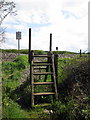
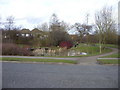
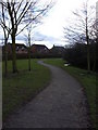
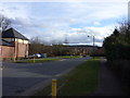
8 photos from this area
Area Information
Key information about the MK7 8DH including its size, population, and administrative classification.
- Area Type
- Postcode
- Area Size
- 2.5 hectares
- Population
- 1728
- Population Density
- 1833 people/km²
House Prices in MK7 8DH
34
Properties
£215,250
Average Sold Price
£35,500
Lowest Price
£585,000
Highest Price
Showing 34 properties
| Address | Type | Beds | Baths | Last Sale Price | Last Sale Date | |
|---|---|---|---|---|---|---|
| 8 Mendelssohn Grove, Browns Wood, Milton Keynes, MK7 8DH | Detached | 4 | 3 | £550,000 | Jun 2025 | |
| 19 Mendelssohn Grove, Browns Wood, Milton Keynes, MK7 8DH | house | 2 | - | £225,000 | Nov 2022 | |
| 26 Mendelssohn Grove, Browns Wood, Milton Keynes, MK7 8DH | Terraced | 2 | 1 | £222,000 | Nov 2022 | |
| 1 Mendelssohn Grove, Browns Wood, Milton Keynes, MK7 8DH | Terraced | 2 | 1 | £585,000 | May 2022 | |
| 10 Mendelssohn Grove, Browns Wood, Milton Keynes, MK7 8DH | Semi-detached | 3 | 1 | £270,000 | Jun 2021 | |
| 25 Mendelssohn Grove, Browns Wood, Milton Keynes, MK7 8DH | Terraced | 2 | 1 | £205,000 | Apr 2021 | |
| 29 Mendelssohn Grove, Browns Wood, Milton Keynes, MK7 8DH | house | 2 | - | £215,000 | Sep 2020 | |
| 13 Mendelssohn Grove, Browns Wood, Milton Keynes, MK7 8DH | Semi-detached | 3 | 1 | £262,000 | May 2020 | |
| 12 Mendelssohn Grove, Browns Wood, Milton Keynes, MK7 8DH | Semi-detached | 3 | 1 | £235,000 | Mar 2020 | |
| 6 Mendelssohn Grove, Browns Wood, Milton Keynes, MK7 8DH | Detached | 4 | 2 | £430,000 | Aug 2018 |
Page 1 of 4
Energy Efficiency in MK7 8DH
Amenities
Schools
| Rank | School | Type | Entry gender | Ages |
|---|
Explore more schools in this area
Go to Schools tabDemographics
Household Size
Family (3-5 people)
most common
Accommodation Type
Houses
most common
Tenure
57
majority
Ethnic Group
White
most common
Religion
N/A
most common
Household Composition
N/A
most common
Age
47
median
Adults (30-64 years)
most common
Household Deprivation
N/A
with no deprivation
NS-SEC
40
in Lower managerial occupations
Explore more demographic insights in this area
Go to Demographics tabPlanning
Planning Constraints
- Flood RiskPremium
- Ramsar Wetland SitesPremium
- Area of Outstanding Natural BeautyPremium
- Protected Nature ReservePremium
- Protected WoodlandPremium