Area Overview for MK7 7JS
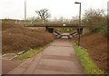
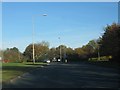
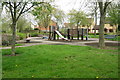
Photos of MK7 7JS


Area Information
MK7 7JS is a small, tightly knit residential postcode in England, home to 1725 people spread across a compact area. With a population density of 1054 people per square kilometre, it’s a densely populated yet manageable cluster of homes, ideal for those seeking a balanced blend of community and convenience. The area is served by multiple rail stations, including Bletchley and Fenny Stratford, offering easy access to nearby towns and cities. Residents benefit from proximity to retail hubs like Tesco Tinkers and The Southern Co-operative, ensuring daily essentials are within reach. While the area lacks large-scale amenities, its compact nature means residents can navigate local services on foot or by bike. The demographic profile suggests a mature, stable community, with a median age of 47 and a strong presence of adults aged 30–64. This makes MK7 7JS a practical choice for those prioritising safety, affordability, and straightforward living.
- Area Type
- Postcode
- Area Size
- Not available
- Population
- 1725
- Population Density
- 1054 people/km²
The property market in MK7 7JS is characterised by high home ownership, with 78% of residents living in owner-occupied homes. This suggests a stable, long-term market with limited rental activity, which may appeal to buyers seeking investment potential or a place to settle permanently. The accommodation type is predominantly houses, indicating a focus on family homes rather than apartments or flats. This aligns with the area’s residential cluster model, where larger properties are more common. Given the compact nature of MK7 7JS, property availability is likely limited, making it a niche market for those prioritising proximity to rail links and retail. Buyers should consider the area’s small size, which may restrict options for expansion or development. The high home ownership rate also implies competitive pricing, with properties holding value due to their scarcity.
House Prices in MK7 7JS
No properties found in this postcode.
Energy Efficiency in MK7 7JS
Living in MK7 7JS offers access to essential retail and transport hubs within walking or cycling distance. Local shops such as Tesco Tinkers, The Southern Co-operative, and Tesco Walnut provide everyday convenience, while nearby rail stations like Bletchley and Fenny Stratford connect residents to broader networks. The area’s compact size means amenities are tightly clustered, reducing the need for long commutes. While there is no mention of parks or leisure facilities in the data, the proximity to rail links and retail suggests a lifestyle focused on practicality and accessibility. The presence of multiple rail stations also implies a community that values connectivity, whether for work, shopping, or socialising. For those prioritising convenience over expansive leisure options, MK7 7JS delivers a straightforward, efficient lifestyle.
Amenities
Schools
| Rank | School | Type | Entry gender | Ages |
|---|
Explore more schools in this area
Go to Schools tabDemographics
The community in MK7 7JS is predominantly composed of adults aged 30–64, reflecting a median age of 47. This suggests a mature population, likely with established careers and families. Home ownership is high, with 78% of residents owning their homes, indicating a stable, long-term demographic. The accommodation type is primarily houses, which aligns with the area’s residential character and suggests a preference for family-friendly housing. The predominant ethnic group is White, though no specific data on diversity or deprivation is provided. The population density of 1054 people per square kilometre implies a moderately sized community where social interactions are frequent. This density, combined with the age profile, points to a neighbourhood where local amenities and services are central to daily life.
Household Size
Accommodation Type
Tenure
Ethnic Group
Religion
Household Composition
Age
Household Deprivation
NS-SEC
Explore more demographic insights in this area
Go to Demographics tabPlanning
Planning Constraints
- Flood RiskPremium
- Ramsar Wetland SitesPremium
- Area of Outstanding Natural BeautyPremium
- Protected Nature ReservePremium
- Protected WoodlandPremium
- Crime RiskPremium