Area Overview for MK7 7BE
Photos of MK7 7BE
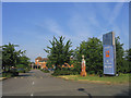
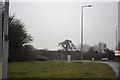
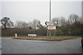
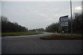


16 photos from this area
Area Information
Key information about the MK7 7BE including its size, population, and administrative classification.
- Area Type
- Postcode
- Area Size
- 4147 m²
- Population
- 1494
- Population Density
- 4244 people/km²
House Prices in MK7 7BE
13
Properties
£257,970
Average Sold Price
£75,000
Lowest Price
£440,000
Highest Price
Showing 13 properties
| Address | Type | Beds | Baths | Last Sale Price | Last Sale Date | |
|---|---|---|---|---|---|---|
| 104 Lichfield Down, Walnut Tree, Milton Keynes, MK7 7BE | Detached | 3 | 1 | £440,000 | Sep 2024 | |
| 90 Lichfield Down, Walnut Tree, Milton Keynes, MK7 7BE | Semi-detached | 3 | 1 | £355,000 | May 2024 | |
| 110 Lichfield Down, Walnut Tree, Milton Keynes, MK7 7BE | house | 3 | 1 | £385,000 | Nov 2021 | |
| 108 Lichfield Down, Walnut Tree, Milton Keynes, MK7 7BE | house | - | - | £390,000 | May 2021 | |
| 100 Lichfield Down, Walnut Tree, Milton Keynes, MK7 7BE | Semi-detached | 3 | 1 | £269,995 | Oct 2018 | |
| 94 Lichfield Down, Walnut Tree, Milton Keynes, MK7 7BE | Semi-detached | 4 | 2 | £300,000 | Feb 2018 | |
| 92 Lichfield Down, Walnut Tree, Milton Keynes, MK7 7BE | house | - | - | £87,150 | Jul 2017 | |
| 102 Lichfield Down, Walnut Tree, Milton Keynes, MK7 7BE | Semi-detached | 3 | 1 | £248,000 | Sep 2016 | |
| 86 Lichfield Down, Walnut Tree, Milton Keynes, MK7 7BE | Semi-detached | 4 | 2 | £260,000 | Oct 2015 | |
| 88 Lichfield Down, Walnut Tree, Milton Keynes, MK7 7BE | Semi-detached | 3 | - | £166,500 | Sep 2005 |
Page 1 of 2
Energy Efficiency in MK7 7BE
Amenities
Schools
| Rank | School | Type | Entry gender | Ages |
|---|
Explore more schools in this area
Go to Schools tabDemographics
Household Size
Family (3-5 people)
most common
Accommodation Type
Houses
most common
Tenure
59
majority
Ethnic Group
White
most common
Religion
N/A
most common
Household Composition
N/A
most common
Age
47
median
Adults (30-64 years)
most common
Household Deprivation
N/A
with no deprivation
NS-SEC
34
in Lower managerial occupations
Explore more demographic insights in this area
Go to Demographics tabPlanning
Planning Constraints
- Flood RiskPremium
- Ramsar Wetland SitesPremium
- Area of Outstanding Natural BeautyPremium
- Protected Nature ReservePremium
- Protected WoodlandPremium