Area Overview for MK7 6ZL
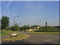
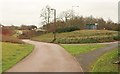
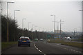
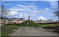
Photos of MK7 6ZL


Area Information
MK7 6ZL is a small, tightly knit residential cluster in England with a population of 1550, serving as a quiet alternative to larger towns. The area is defined by its compact size and low density, offering a calm, community-focused environment. Daily life here is shaped by its proximity to essential services and transport links, with residents benefiting from a balance of convenience and tranquillity. The area’s demographics suggest a mature population, with a median age of 47 and a majority of residents aged 30–64. This age group dominates, reflecting a stable, established community. The absence of major industrial or commercial zones ensures a residential character that prioritises privacy and low traffic. While the area lacks the vibrancy of urban centres, its small size fosters a sense of familiarity, where local amenities and social networks are easily accessible. For those seeking a slower pace of life without sacrificing connectivity, MK7 6ZL offers a straightforward appeal. Its low crime risk and flood safety further enhance its appeal as a secure, predictable place to live.
- Area Type
- Postcode
- Area Size
- Not available
- Population
- 1550
- Population Density
- 4357 people/km²
The property market in MK7 6ZL is characterised by a high rate of home ownership (70%) and a focus on houses rather than flats or apartments. This suggests a market skewed towards owner-occupied properties, with limited rental activity. The predominance of houses indicates larger, more spacious homes, which may be suitable for families or individuals prioritising private outdoor space. Given the area’s small size and low population density, the housing stock is likely limited, making it a niche market for buyers seeking specific properties. The high home ownership rate also implies a stable market with fewer speculative investments. For those considering purchases, the area’s compact nature means proximity to amenities and transport is a key selling point. However, the limited availability of properties may result in competitive bidding for available homes, particularly those with desirable features.
House Prices in MK7 6ZL
No properties found in this postcode.
Energy Efficiency in MK7 6ZL
Living in MK7 6ZL provides access to a range of practical amenities within close reach. Retail options include The Southern Co-operative Co, Aldi Winchester, and Tesco Walnut, ensuring everyday shopping needs are met without long journeys. The area’s rail network, with stations such as Bow Brickhill and Woburn Sands, connects residents to nearby towns, while Cranfield Airport offers regional travel opportunities. Though the area lacks large parks or leisure facilities, its proximity to rail services and retail hubs supports a convenient lifestyle. The presence of multiple railway stations also means residents can easily access cultural or recreational destinations in nearby towns. The compact nature of MK7 6ZL ensures that essential services are never far, fostering a self-contained, low-stress environment. For those prioritising ease of access over expansive leisure options, this area delivers practicality and simplicity.
Amenities
Schools
| Rank | School | Type | Entry gender | Ages |
|---|
Explore more schools in this area
Go to Schools tabDemographics
The community in MK7 6ZL is predominantly composed of adults aged 30–64, with a median age of 47. This suggests a population that is largely settled, with fewer young families or retirees compared to other areas. Home ownership is high, at 70%, indicating a strong presence of long-term residents who have invested in their properties. The accommodation type is primarily houses, which aligns with the area’s low density and residential focus. The predominant ethnic group is White, reflecting a homogenous demographic profile. While no specific data on deprivation is provided, the high home ownership rate and stable age distribution suggest a community with relatively consistent economic stability. This profile may appeal to buyers seeking a low-maintenance, established neighbourhood with minimal turnover. The absence of significant diversity data means the area’s cultural landscape remains largely unexplored in this context.
Household Size
Accommodation Type
Tenure
Ethnic Group
Religion
Household Composition
Age
Household Deprivation
NS-SEC
Explore more demographic insights in this area
Go to Demographics tabPlanning
Planning Constraints
- Flood RiskPremium
- Ramsar Wetland SitesPremium
- Area of Outstanding Natural BeautyPremium
- Protected Nature ReservePremium
- Protected WoodlandPremium