Area Overview for MK6 2DZ
Photos of MK6 2DZ


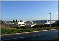
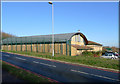
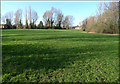
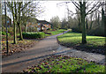


25 photos from this area
Area Information
Key information about the MK6 2DZ including its size, population, and administrative classification.
- Area Type
- Postcode
- Area Size
- 1.2 hectares
- Population
- 1825
- Population Density
- 8352 people/km²
House Prices in MK6 2DZ
36
Properties
£212,278
Average Sold Price
£116,000
Lowest Price
£325,000
Highest Price
Showing 36 properties
| Address | Type | Beds | Baths | Last Sale Price | Last Sale Date | |
|---|---|---|---|---|---|---|
| 65 Polruan Place, Fishermead, Milton Keynes, MK6 2DZ | house | - | - | £290,000 | Aug 2025 | |
| 81 Polruan Place, Fishermead, Milton Keynes, MK6 2DZ | house | 4 | 1 | £325,000 | May 2025 | |
| 61 Polruan Place, Fishermead, Milton Keynes, MK6 2DZ | house | 5 | 2 | £290,000 | May 2024 | |
| 79 Polruan Place, Fishermead, Milton Keynes, MK6 2DZ | Terraced | 3 | 2 | £251,000 | Oct 2023 | |
| 85 Polruan Place, Fishermead, Milton Keynes, MK6 2DZ | house | - | - | £217,500 | Mar 2016 | |
| 73 Polruan Place, Fishermead, Milton Keynes, MK6 2DZ | house | 3 | - | £165,000 | Sep 2014 | |
| 91 Polruan Place, Fishermead, Milton Keynes, MK6 2DZ | house | 3 | - | £125,000 | Jul 2011 | |
| 59 Polruan Place, Fishermead, Milton Keynes, MK6 2DZ | Retail | 5 | 5 | £131,000 | Jul 2005 | |
| 67 Polruan Place, Fishermead, Milton Keynes, MK6 2DZ | house | - | - | £116,000 | Jun 2003 | |
| Room 4, 77 Polruan Place, Fishermead, Milton Keynes, MK6 2DZ | Unknown | - | - | - | - |
Page 1 of 4
Energy Efficiency in MK6 2DZ
Amenities
Schools
| Rank | School | Type | Entry gender | Ages |
|---|
Explore more schools in this area
Go to Schools tabDemographics
Household Size
Family (3-5 people)
most common
Accommodation Type
Houses
most common
Tenure
20
majority
Ethnic Group
White
most common
Religion
N/A
most common
Household Composition
N/A
most common
Age
47
median
Adults (30-64 years)
most common
Household Deprivation
N/A
with no deprivation
NS-SEC
15
in Lower managerial occupations
Explore more demographic insights in this area
Go to Demographics tabPlanning
Planning Constraints
- Flood RiskPremium
- Ramsar Wetland SitesPremium
- Area of Outstanding Natural BeautyPremium
- Protected Nature ReservePremium
- Protected WoodlandPremium