Area Overview for MK5 7XX
Photos of MK5 7XX


Area Information
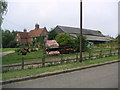
MK5 7XX is a compact residential postcode area in Milton Keynes, covering just 3.9 hectares. Despite its small size, it is densely populated, with 2,096 residents packed into a space of 54,324 people per square kilometre. This makes it one of the most densely inhabited areas in England. The area is characterised by its cluster of homes, primarily owner-occupied properties, reflecting a community of long-term residents. Daily life here is shaped by proximity to essential services, including retail outlets and rail links. The area’s compact nature means residents have quick access to amenities, though the limited space also means the community feels tightly knit. With no major environmental constraints or protected sites nearby, the area is practical for those prioritising convenience over natural landscapes. Its location within Milton Keynes offers a balance of suburban living and urban connectivity, making it a viable option for those seeking a focused, accessible neighbourhood.
- Area Type
- Postcode
- Area Size
- 3.9 hectares
- Population
- 2096
- Population Density
- 3632 people/km²
MK5 7XX is primarily an owner-occupied area, with 71% of properties owned by their residents. The accommodation type is predominantly houses, which is atypical for Milton Keynes, where flats and terraced housing are more common. This suggests a niche market catering to those seeking single-family homes in a compact, high-density postcode. The limited area size means the housing stock is small, and the immediate surroundings may offer limited expansion. For buyers, this presents both opportunities and constraints: properties are likely to be in high demand due to their rarity, but the small footprint of the area may restrict availability. The focus on owner-occupation indicates a community of established residents, which could influence property values and the character of the local market.
House Prices in MK5 7XX
No properties found in this postcode.
Energy Efficiency in MK5 7XX
Residents of MK5 7XX have access to a range of retail and transport amenities within practical reach. Nearby supermarkets include Aldi Emerson, Tesco Milton Keynes, and Morrisons Emerson, offering convenience for daily shopping. The area’s proximity to multiple railway stations—Milton Keynes Central, Bletchley, and Fenny Stratford—provides easy access to regional and national transport networks. While the data does not mention parks or leisure facilities, the absence of protected natural areas suggests a focus on urban living. The compact nature of the area means amenities are closely clustered, reducing travel time for essentials. This concentration of retail and transport options supports a lifestyle that prioritises efficiency, though the small footprint may limit opportunities for outdoor recreation or expansive community spaces.
Amenities
Schools
The nearest school to MK5 7XX is Long Meadow School, a primary school with a good Ofsted rating. This provides families with access to a well-regarded early education option. The absence of secondary schools in the immediate area means parents may need to consider commuting for secondary education, though Milton Keynes as a whole has a range of secondary schools. The presence of a primary school with a good rating is a positive factor for families prioritising quality education, though the data does not indicate the proximity of other educational institutions. The school’s rating suggests a focus on academic standards and student welfare, which could be a draw for families seeking reliable schooling.
| Rank | School | Type | Entry gender | Ages |
|---|
Explore more schools in this area
Go to Schools tabDemographics
The population of MK5 7XX has a median age of 47, with the majority of residents falling within the 30–64 age range. This suggests a mature, stable community with a strong presence of working-age adults. Home ownership is high at 71%, indicating a predominance of long-term residents rather than transient renters. The accommodation type is predominantly houses, which is unusual for Milton Keynes, where flats are more common. The predominant ethnic group is White, and no specific data on deprivation or diversity is provided. The age profile and home ownership rate suggest a community that values stability and property investment. The high proportion of adults in their prime working years may influence local services and amenities, though the data does not specify the presence of younger families or retirees.
Household Size
Accommodation Type
Tenure
Ethnic Group
Religion
Household Composition
Age
Household Deprivation
NS-SEC
Explore more demographic insights in this area
Go to Demographics tabPlanning
Planning Constraints
- Flood RiskPremium
- Ramsar Wetland SitesPremium
- Area of Outstanding Natural BeautyPremium
- Protected Nature ReservePremium
- Protected WoodlandPremium