Area Overview for MK5 7WD
Photos of MK5 7WD


Area Information
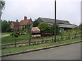
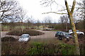
MK5 7WD is a small residential cluster in Milton Keynes, England, with a population of 2217. The area is characterised by its compact size and proximity to essential services, making it a practical choice for those seeking a balance between suburban comfort and urban accessibility. Daily life here is shaped by a mature community, with residents predominantly aged 30–64, reflecting a stable demographic. The area’s low flood risk and absence of environmental constraints such as protected woodlands or Ramsar sites suggest a relatively straightforward planning environment. However, crime rates are above average, which prospective buyers should consider. Despite this, the area benefits from strong digital connectivity and nearby rail links, offering residents flexibility in work and leisure. MK5 7WD is not a sprawling suburb but a focused postcode where homes are closely grouped, fostering a tight-knit feel. For those prioritising safety, practicality, and proximity to amenities, this area offers a distinct blend of residential simplicity and functional infrastructure.
- Area Type
- Postcode
- Area Size
- Not available
- Population
- 2217
- Population Density
- 3219 people/km²
MK5 7WD is primarily a housing area where 49% of residents own their homes, with the remaining 51% renting. The accommodation type is predominantly houses, which is unusual for Milton Keynes, where flats are more common. This suggests a niche market catering to buyers seeking traditional homes rather than apartments. The small size of the area means the housing stock is limited, and properties are likely to be closely grouped. For buyers, this could mean a competitive market with limited options, but the focus on houses may appeal to those prioritising space and private gardens. The low flood risk and absence of environmental constraints also make it a viable option for long-term investment. However, the high crime risk may deter some buyers, particularly those concerned about safety.
House Prices in MK5 7WD
No properties found in this postcode.
Energy Efficiency in MK5 7WD
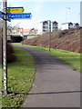
MK5 7WD offers a range of retail amenities within easy reach, including Aldi Emerson, Morrisons Emerson, and Tesco Milton Keynes. These stores provide everyday shopping convenience, from groceries to household essentials. The area’s rail stations—Milton Keynes Central, Bletchley, and Fenny Stratford—connect residents to broader networks, enabling access to cultural, leisure, and professional opportunities in Milton Keynes and beyond. While the data does not specify parks or leisure facilities, the proximity to major retail hubs and transport links suggests a lifestyle focused on practicality and accessibility. For residents, the blend of shopping, transport, and low environmental constraints creates a functional environment suited to those prioritising convenience over sprawling green spaces.
Amenities
Schools
The nearest school to MK5 7WD is Shenley Brook End School, which operates as both a primary school and an academy with a good Ofsted rating. This dual role provides families with a single educational institution serving multiple stages of a child’s schooling, reducing the need for multiple school transfers. The good Ofsted rating indicates a reliable standard of education, though the absence of secondary schools in the immediate area may require students to commute. For families prioritising convenience, the proximity of a well-rated primary and academy is a significant advantage. However, those needing secondary education should consider the distance to nearby schools in Milton Keynes, which may add to daily travel time.
| Rank | School | Type | Entry gender | Ages |
|---|
Explore more schools in this area
Go to Schools tabDemographics
The population of MK5 7WD is 2217, with a median age of 47. The most common age range is adults aged 30–64, indicating a community skewed towards middle-aged residents. Home ownership stands at 49%, suggesting a mix of owner-occupied properties and rental units. The predominant ethnic group is White, reflecting a relatively homogeneous demographic. This age profile implies a stable, established community with fewer young families compared to other areas. The 49% home ownership rate means nearly half of residents rent, which may influence the local property market dynamics. The absence of specific data on deprivation levels means it is unclear how economic factors impact quality of life, but the age range and ownership statistics suggest a population focused on long-term stability rather than transient living.
Household Size
Accommodation Type
Tenure
Ethnic Group
Religion
Household Composition
Age
Household Deprivation
NS-SEC
Explore more demographic insights in this area
Go to Demographics tabPlanning
Planning Constraints
- Flood RiskPremium
- Ramsar Wetland SitesPremium
- Area of Outstanding Natural BeautyPremium
- Protected Nature ReservePremium
- Protected WoodlandPremium