Area Overview for MK46 5ZS
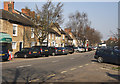
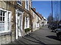
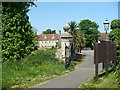
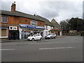
Photos of MK46 5ZS


Area Information
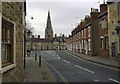
Living in MK46 5ZS offers a quiet, residential lifestyle in a small cluster of homes with a population of 1,907 and a low density of 102 people per square kilometre. This area is characterised by its compact size and the presence of family-oriented amenities. The community is largely composed of adults aged 30–64, with a median age of 47, suggesting a mature, settled population. Home ownership is high at 70%, with most properties being houses rather than flats, reflecting a traditional, stable housing stock. The area is served by two primary schools, including an outstanding-rated academy, which supports families with children. Nearby retail options like Co-op Olney, Morrisons Daily, and Tesco Olney provide daily conveniences. While the postcode is small, its proximity to these services and schools makes it appealing for those seeking a balance between privacy and accessibility. The low crime risk and absence of environmental constraints further enhance its appeal as a safe, low-maintenance place to live.
- Area Type
- Postcode
- Area Size
- Not available
- Population
- 1907
- Population Density
- 102 people/km²
The property market in MK46 5ZS is dominated by owner-occupied homes, with 70% of properties owned by residents rather than rented. This indicates a stable, long-term community with fewer short-term rental properties. The accommodation type is primarily houses, which contrasts with areas where flats or apartments predominate. This housing stock suggests a focus on family homes with more space, aligning with the area’s mature population and school infrastructure. For buyers, this means a market where properties are likely to be in good condition and hold value over time. However, the small size of the postcode and its focus on houses may limit availability, making it a niche market for those seeking a specific type of property. The low population density also implies that new developments are unlikely, preserving the existing character of the area.
House Prices in MK46 5ZS
No properties found in this postcode.
Energy Efficiency in MK46 5ZS
Residents of MK46 5ZS benefit from nearby retail amenities, including Co-op Olney, Morrisons Daily, and Tesco Olney, which provide essential shopping, groceries, and services. These stores are within practical reach, reducing the need for long trips to larger towns. While the data does not specify other leisure or park facilities, the presence of multiple retail outlets suggests a community that values convenience and local commerce. The area’s small size means that daily errands can be completed quickly, and the mix of established retail names indicates a well-served local economy. For families, the proximity of schools and shops creates a self-contained environment where children can walk to school and parents can manage household needs without relying on distant amenities. The character of the area is defined by its accessibility and the balance between private living and community resources.
Amenities
Schools
Residents of MK46 5ZS have access to two primary schools within practical reach. Olney Infant School provides standard primary education, while Olney Infant Academy, an academy with an outstanding Ofsted rating, offers a higher standard of teaching and resources. The presence of both a traditional school and an academy gives families options, whether they prioritise established institutions or innovative educational approaches. These schools are likely to be key factors for families considering the area, as they provide a foundation for children’s early education. The proximity of these schools to homes in MK46 5ZS ensures that parents can easily access drop-offs, pick-ups, and school events. With an outstanding-rated academy nearby, the area’s educational offerings are a strong selling point for families seeking quality schooling without long commutes.
| Rank | School | Type | Entry gender | Ages |
|---|
Explore more schools in this area
Go to Schools tabDemographics
The community in MK46 5ZS is predominantly composed of adults aged 30–64, with a median age of 47. This suggests a population that is largely in their prime working years, with fewer young families or retirees compared to other areas. Home ownership is strong, with 70% of residents owning their homes, and the majority of properties are houses rather than flats. The predominant ethnic group is White, indicating a relatively homogenous demographic. The low population density of 102 people per square kilometre means the area is not densely populated, contributing to a quieter, more spread-out living environment. While specific data on deprivation is not provided, the high home ownership and stable age profile suggest a community with moderate economic stability. The absence of significant diversity metrics in the data means the area’s social fabric is largely defined by its core demographic group.
Household Size
Accommodation Type
Tenure
Ethnic Group
Religion
Household Composition
Age
Household Deprivation
NS-SEC
Explore more demographic insights in this area
Go to Demographics tabPlanning
Planning Constraints
- Flood RiskPremium
- Ramsar Wetland SitesPremium
- Area of Outstanding Natural BeautyPremium
- Protected Nature ReservePremium
- Protected WoodlandPremium