Area Overview for MK46 5HH
Photos of MK46 5HH
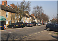
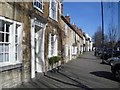

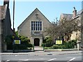
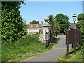
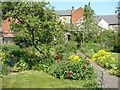
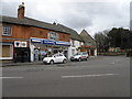
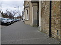
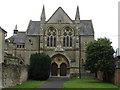
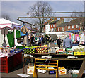
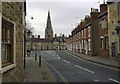
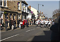
98 photos from this area
Area Information
Key information about the MK46 5HH including its size, population, and administrative classification.
- Area Type
- Postcode
- Area Size
- 8341 m²
- Population
- 1702
- Population Density
- 4354 people/km²
House Prices in MK46 5HH
8
Properties
£213,125
Average Sold Price
£140,000
Lowest Price
£285,000
Highest Price
Showing 8 properties
| Address | Type | Beds | Baths | Last Sale Price | Last Sale Date | |
|---|---|---|---|---|---|---|
| 43 West Street, Olney, MK46 5HH | house | 2 | 1 | £285,000 | Oct 2024 | |
| 47 West Street, Olney, MK46 5HH | house | 2 | - | £250,000 | Jan 2023 | |
| 49 West Street, Olney, MK46 5HH | house | 2 | 1 | £177,500 | Nov 2019 | |
| 45 West Street, Olney, MK46 5HH | house | 2 | 1 | £140,000 | Nov 2009 | |
| St Josephs Convent, 37 West Street, Olney, MK46 5HH | commercial | - | - | - | - | |
| Catholic Church Of Our Lady And St Laurence, 41 West Street, Olney, MK46 5HH | Detached | - | - | - | - | |
| St Josephs Convent, West Street, Olney, MK46 5HH | Retirement | - | - | - | - | |
| St Josephs Convent, 33 West Street, Olney, MK46 5HH | hospital_care_home | - | - | - | - |
Energy Efficiency in MK46 5HH
Amenities
Schools
| Rank | School | Type | Entry gender | Ages |
|---|
Explore more schools in this area
Go to Schools tabDemographics
Household Size
Two person
most common
Accommodation Type
Houses
most common
Tenure
71
majority
Ethnic Group
White
most common
Religion
N/A
most common
Household Composition
N/A
most common
Age
47
median
Adults (30-64 years)
most common
Household Deprivation
N/A
with no deprivation
NS-SEC
48
in Lower managerial occupations
Explore more demographic insights in this area
Go to Demographics tabPlanning
Planning Constraints
- Flood RiskPremium
- Ramsar Wetland SitesPremium
- Area of Outstanding Natural BeautyPremium
- Protected Nature ReservePremium
- Protected WoodlandPremium