Area Overview for MK46 5DH
Photos of MK46 5DH
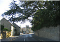
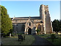
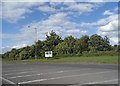
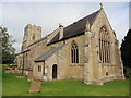
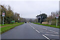
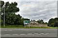
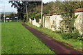
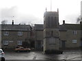
13 photos from this area
Area Information
Key information about the MK46 5DH including its size, population, and administrative classification.
- Area Type
- Postcode
- Area Size
- 5396 m²
- Population
- 1313
- Population Density
- 56 people/km²
House Prices in MK46 5DH
14
Properties
£326,417
Average Sold Price
£15,000
Lowest Price
£786,000
Highest Price
Showing 14 properties
| Address | Type | Beds | Baths | Last Sale Price | Last Sale Date | |
|---|---|---|---|---|---|---|
| 11 High Street, Emberton, MK46 5DH | Detached | 4 | 1 | £786,000 | Jan 2025 | |
| 14 High Street, Emberton, MK46 5DH | Terraced | 2 | 1 | £330,000 | Oct 2023 | |
| 20 High Street, Emberton, MK46 5DH | Terraced | 3 | 2 | £332,500 | Jul 2023 | |
| 1 High Street, Emberton, MK46 5DH | Terraced | 4 | - | £300,000 | Jul 2005 | |
| 16 High Street, Emberton, MK46 5DH | Terraced | 3 | - | £15,000 | Dec 2001 | |
| Sycamore Cottage, 10 High Street, Emberton, MK46 5DH | house | 5 | - | £195,000 | Jun 1998 | |
| The Flat, The Bell And Bear, 12 High Street, Emberton, MK46 5DH | Flat | - | - | - | - | |
| 4 High Street, Emberton, MK46 5DH | Terraced | - | - | - | - | |
| 5 High Street, Emberton, MK46 5DH | Detached | - | - | - | - | |
| 3 High Street, Emberton, MK46 5DH | Flat | - | - | - | - |
Page 1 of 2
Energy Efficiency in MK46 5DH
Amenities
Schools
| Rank | School | Type | Entry gender | Ages |
|---|
Explore more schools in this area
Go to Schools tabDemographics
Household Size
Two person
most common
Accommodation Type
Houses
most common
Tenure
74
majority
Ethnic Group
White
most common
Religion
N/A
most common
Household Composition
N/A
most common
Age
47
median
Adults (30-64 years)
most common
Household Deprivation
N/A
with no deprivation
NS-SEC
43
in Lower managerial occupations
Explore more demographic insights in this area
Go to Demographics tabPlanning
Planning Constraints
- Flood RiskPremium
- Ramsar Wetland SitesPremium
- Area of Outstanding Natural BeautyPremium
- Protected Nature ReservePremium
- Protected WoodlandPremium