Area Overview for MK46 5AF
Photos of MK46 5AF
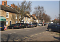
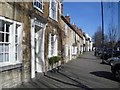
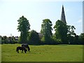

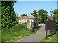


98 photos from this area
Area Information
Key information about the MK46 5AF including its size, population, and administrative classification.
- Area Type
- Postcode
- Area Size
- 1.0 hectares
- Population
- 1872
- Population Density
- 346 people/km²
House Prices in MK46 5AF
13
Properties
£512,571
Average Sold Price
£163,000
Lowest Price
£925,000
Highest Price
Showing 13 properties
| Address | Type | Beds | Baths | Last Sale Price | Last Sale Date | |
|---|---|---|---|---|---|---|
| 150 Weston Road, Olney, MK46 5AF | house | - | - | £800,000 | Jan 2023 | |
| 156 Weston Road, Olney, MK46 5AF | Detached | 6 | - | £925,000 | Nov 2018 | |
| 158 Weston Road, Olney, MK46 5AF | house | - | - | £705,000 | Oct 2009 | |
| 152 Weston Road, Olney, MK46 5AF | house | - | - | £335,000 | May 2009 | |
| 142 Weston Road, Olney, MK46 5AF | Detached | - | - | £485,000 | Dec 2004 | |
| 144 Weston Road, Olney, MK46 5AF | Detached | - | - | £175,000 | May 1999 | |
| 146 Weston Road, Olney, MK46 5AF | Detached | - | - | £163,000 | Mar 1998 | |
| 138 Weston Road, Olney, MK46 5AF | Detached | - | - | - | - | |
| 154 Weston Road, Olney, MK46 5AF | house | - | - | - | - | |
| 148 Weston Road, Olney, MK46 5AF | Detached | - | - | - | - |
Page 1 of 2
Energy Efficiency in MK46 5AF
Amenities
Schools
| Rank | School | Type | Entry gender | Ages |
|---|
Explore more schools in this area
Go to Schools tabDemographics
Household Size
Two person
most common
Accommodation Type
Houses
most common
Tenure
82
majority
Ethnic Group
White
most common
Religion
N/A
most common
Household Composition
N/A
most common
Age
47
median
Adults (30-64 years)
most common
Household Deprivation
N/A
with no deprivation
NS-SEC
52
in Lower managerial occupations
Explore more demographic insights in this area
Go to Demographics tabPlanning
Planning Constraints
- Flood RiskPremium
- Ramsar Wetland SitesPremium
- Area of Outstanding Natural BeautyPremium
- Protected Nature ReservePremium
- Protected WoodlandPremium