Area Overview for MK46 4EU
Photos of MK46 4EU
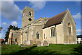
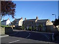
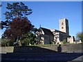
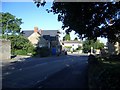
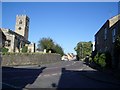
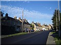
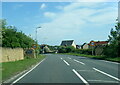
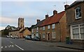
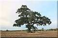
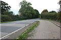

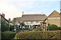
19 photos from this area
Area Information
Key information about the MK46 4EU including its size, population, and administrative classification.
- Area Type
- Postcode
- Area Size
- 1.7 hectares
- Population
- 1793
- Population Density
- 86 people/km²
House Prices in MK46 4EU
24
Properties
£270,967
Average Sold Price
£110,000
Lowest Price
£480,000
Highest Price
Showing 24 properties
| Address | Type | Beds | Baths | Last Sale Price | Last Sale Date | |
|---|---|---|---|---|---|---|
| 8 Olney Road, Lavendon, MK46 4EU | Detached | 3 | - | £480,000 | Nov 2024 | |
| 25 Olney Road, Lavendon, MK46 4EU | Terraced | 3 | 2 | £368,000 | Sep 2021 | |
| 22 Olney Road, Lavendon, MK46 4EU | Semi-detached | 4 | 1 | £350,000 | Jun 2021 | |
| 3 Olney Road, Lavendon, MK46 4EU | house | 2 | - | £290,000 | Sep 2019 | |
| 35 Olney Road, Lavendon, MK46 4EU | Detached | 4 | 3 | £342,500 | Mar 2017 | |
| 19 Olney Road, Lavendon, MK46 4EU | house | - | - | £300,000 | Jan 2017 | |
| 16 Olney Road, Lavendon, MK46 4EU | Bungalow | 4 | - | £265,000 | Jul 2015 | |
| 7 Olney Road, Lavendon, MK46 4EU | Terraced | 3 | 1 | £242,500 | Sep 2014 | |
| 23 Olney Road, Lavendon, MK46 4EU | Terraced | 3 | 1 | £206,500 | Oct 2013 | |
| 27 Olney Road, Lavendon, MK46 4EU | Terraced | 3 | - | £290,000 | Feb 2010 |
Page 1 of 3
Energy Efficiency in MK46 4EU
Amenities
Schools
| Rank | School | Type | Entry gender | Ages |
|---|
Explore more schools in this area
Go to Schools tabDemographics
Household Size
Two person
most common
Accommodation Type
Houses
most common
Tenure
77
majority
Ethnic Group
White
most common
Religion
N/A
most common
Household Composition
N/A
most common
Age
47
median
Adults (30-64 years)
most common
Household Deprivation
N/A
with no deprivation
NS-SEC
45
in Lower managerial occupations
Explore more demographic insights in this area
Go to Demographics tabPlanning
Planning Constraints
- Flood RiskPremium
- Ramsar Wetland SitesPremium
- Area of Outstanding Natural BeautyPremium
- Protected Nature ReservePremium
- Protected WoodlandPremium