Area Overview for MK4 4GS
Photos of MK4 4GS
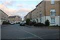
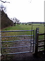
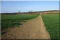
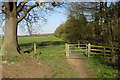
23 photos from this area
Area Information
Key information about the MK4 4GS including its size, population, and administrative classification.
- Area Type
- Postcode
- Area Size
- 1.6 hectares
- Population
- 1604
- Population Density
- 6884 people/km²
House Prices in MK4 4GS
40
Properties
£223,701
Average Sold Price
£70,000
Lowest Price
£575,000
Highest Price
Showing 40 properties
| Address | Type | Beds | Baths | Last Sale Price | Last Sale Date | |
|---|---|---|---|---|---|---|
| 21 Merman Rise, Oxley Park, Milton Keynes, MK4 4GS | Semi-detached | 4 | 2 | £400,000 | Mar 2025 | |
| 41 Merman Rise, Oxley Park, Milton Keynes, MK4 4GS | Terraced | 4 | 3 | £450,000 | Mar 2025 | |
| 31 Merman Rise, Oxley Park, Milton Keynes, MK4 4GS | Flat | 1 | 1 | £82,500 | Oct 2024 | |
| 40 Merman Rise, Oxley Park, Milton Keynes, MK4 4GS | Flat | - | - | £92,000 | Aug 2022 | |
| 42 Merman Rise, Oxley Park, Milton Keynes, MK4 4GS | Flat | - | - | £217,000 | Feb 2022 | |
| 29 Merman Rise, Oxley Park, Milton Keynes, MK4 4GS | Flat | - | - | £105,000 | Jul 2021 | |
| 16 Merman Rise, Oxley Park, Milton Keynes, MK4 4GS | house | - | - | £500,000 | Jun 2021 | |
| 1 Merman Rise, Oxley Park, Milton Keynes, MK4 4GS | house | 2 | - | £200,000 | Feb 2021 | |
| 39 Merman Rise, Oxley Park, Milton Keynes, MK4 4GS | Flat | - | - | £190,000 | Dec 2020 | |
| 15 Merman Rise, Oxley Park, Milton Keynes, MK4 4GS | Semi-detached | 4 | 4 | £447,500 | Apr 2018 |
Page 1 of 4
Energy Efficiency in MK4 4GS
Amenities
Schools
| Rank | School | Type | Entry gender | Ages |
|---|
Explore more schools in this area
Go to Schools tabDemographics
Household Size
Family (3-5 people)
most common
Accommodation Type
Houses
most common
Tenure
75
majority
Ethnic Group
White
most common
Religion
N/A
most common
Household Composition
N/A
most common
Age
47
median
Adults (30-64 years)
most common
Household Deprivation
N/A
with no deprivation
NS-SEC
53
in Lower managerial occupations
Explore more demographic insights in this area
Go to Demographics tabPlanning
Planning Constraints
- Flood RiskPremium
- Ramsar Wetland SitesPremium
- Area of Outstanding Natural BeautyPremium
- Protected Nature ReservePremium
- Protected WoodlandPremium