Area Overview for MK4 3FA
Photos of MK4 3FA
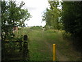
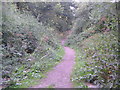
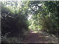
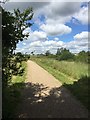
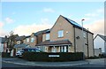
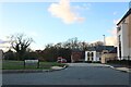
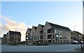
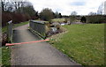
28 photos from this area
Area Information
Key information about the MK4 3FA including its size, population, and administrative classification.
- Area Type
- Postcode
- Area Size
- 1.2 hectares
- Population
- 1851
- Population Density
- 1850 people/km²
House Prices in MK4 3FA
20
Properties
£235,441
Average Sold Price
£120,500
Lowest Price
£462,000
Highest Price
Showing 20 properties
| Address | Type | Beds | Baths | Last Sale Price | Last Sale Date | |
|---|---|---|---|---|---|---|
| 95 Portishead Drive, Tattenhoe, Milton Keynes, MK4 3FA | Detached | 3 | 2 | £462,000 | May 2022 | |
| 75 Portishead Drive, Tattenhoe, Milton Keynes, MK4 3FA | Flat | - | - | £230,000 | Oct 2021 | |
| 89 Portishead Drive, Tattenhoe, Milton Keynes, MK4 3FA | Detached | 3 | 3 | £358,000 | Aug 2020 | |
| 85 Portishead Drive, Tattenhoe, Milton Keynes, MK4 3FA | Flat | - | - | £222,500 | Aug 2018 | |
| 103 Portishead Drive, Tattenhoe, Milton Keynes, MK4 3FA | Semi-detached | 3 | 1 | £290,000 | Aug 2017 | |
| 79 Portishead Drive, Tattenhoe, Milton Keynes, MK4 3FA | Flat | 2 | 2 | £225,000 | Apr 2017 | |
| 77 Portishead Drive, Tattenhoe, Milton Keynes, MK4 3FA | Flat | - | - | £199,995 | Apr 2015 | |
| 73 Portishead Drive, Tattenhoe, Milton Keynes, MK4 3FA | Flat | 3 | 1 | £171,000 | Oct 2013 | |
| 71 Portishead Drive, Tattenhoe, Milton Keynes, MK4 3FA | Flat | - | - | £198,000 | Dec 2006 | |
| 97 Portishead Drive, Tattenhoe, Milton Keynes, MK4 3FA | Detached | 4 | 3 | £293,500 | Aug 2006 |
Page 1 of 2
Energy Efficiency in MK4 3FA
Amenities
Schools
| Rank | School | Type | Entry gender | Ages |
|---|
Explore more schools in this area
Go to Schools tabDemographics
Household Size
Family (3-5 people)
most common
Accommodation Type
Houses
most common
Tenure
79
majority
Ethnic Group
White
most common
Religion
N/A
most common
Household Composition
N/A
most common
Age
47
median
Adults (30-64 years)
most common
Household Deprivation
N/A
with no deprivation
NS-SEC
48
in Lower managerial occupations
Explore more demographic insights in this area
Go to Demographics tabPlanning
Planning Constraints
- Flood RiskPremium
- Ramsar Wetland SitesPremium
- Area of Outstanding Natural BeautyPremium
- Protected Nature ReservePremium
- Protected WoodlandPremium