Area Overview for MK4 3BU
Photos of MK4 3BU


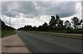
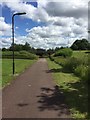
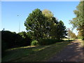
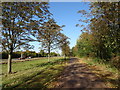
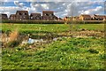


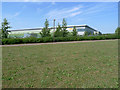
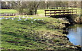

22 photos from this area
Area Information
Key information about the MK4 3BU including its size, population, and administrative classification.
- Area Type
- Postcode
- Area Size
- 1.4 hectares
- Population
- 1632
- Population Density
- 4659 people/km²
House Prices in MK4 3BU
19
Properties
£278,655
Average Sold Price
£120,000
Lowest Price
£510,000
Highest Price
Showing 19 properties
| Address | Type | Beds | Baths | Last Sale Price | Last Sale Date | |
|---|---|---|---|---|---|---|
| 7 Sharkham Court, Tattenhoe, Milton Keynes, MK4 3BU | Detached | 4 | 2 | £497,500 | Aug 2024 | |
| 19 Sharkham Court, Tattenhoe, Milton Keynes, MK4 3BU | Detached | 4 | 2 | £504,000 | Jul 2023 | |
| 17 Sharkham Court, Tattenhoe, Milton Keynes, MK4 3BU | Detached | 4 | 2 | £510,000 | Dec 2022 | |
| 2 Sharkham Court, Tattenhoe, Milton Keynes, MK4 3BU | house | - | - | £445,000 | Jan 2021 | |
| 4 Sharkham Court, Tattenhoe, Milton Keynes, MK4 3BU | Detached | 4 | 2 | £430,000 | Nov 2018 | |
| 1 Sharkham Court, Tattenhoe, Milton Keynes, MK4 3BU | Detached | 4 | 2 | £342,000 | Jul 2014 | |
| 9 Sharkham Court, Tattenhoe, Milton Keynes, MK4 3BU | Detached | 4 | - | £282,500 | Oct 2013 | |
| 8 Sharkham Court, Tattenhoe, Milton Keynes, MK4 3BU | house | - | - | £281,000 | Feb 2013 | |
| 11 Sharkham Court, Tattenhoe, Milton Keynes, MK4 3BU | Semi-detached | 4 | - | £297,000 | Oct 2012 | |
| 12 Sharkham Court, Tattenhoe, Milton Keynes, MK4 3BU | house | 4 | - | £285,000 | Aug 2011 |
Page 1 of 2
Energy Efficiency in MK4 3BU
Amenities
Schools
| Rank | School | Type | Entry gender | Ages |
|---|
Explore more schools in this area
Go to Schools tabDemographics
Household Size
Family (3-5 people)
most common
Accommodation Type
Houses
most common
Tenure
67
majority
Ethnic Group
White
most common
Religion
N/A
most common
Household Composition
N/A
most common
Age
47
median
Adults (30-64 years)
most common
Household Deprivation
N/A
with no deprivation
NS-SEC
43
in Lower managerial occupations
Explore more demographic insights in this area
Go to Demographics tabPlanning
Planning Constraints
- Flood RiskPremium
- Ramsar Wetland SitesPremium
- Area of Outstanding Natural BeautyPremium
- Protected Nature ReservePremium
- Protected WoodlandPremium