Area Overview for MK3 6FP
Photos of MK3 6FP

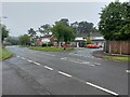
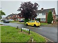
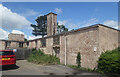
60 photos from this area
Area Information
Key information about the MK3 6FP including its size, population, and administrative classification.
- Area Type
- Postcode
- Area Size
- 6.8 hectares
- Population
- 2912
- Population Density
- 3191 people/km²
House Prices in MK3 6FP
56
Properties
£306,065
Average Sold Price
£230,000
Lowest Price
£405,000
Highest Price
Showing 56 properties
| Address | Type | Beds | Baths | Last Sale Price | Last Sale Date | |
|---|---|---|---|---|---|---|
| 5 Bunkers Crescent, Bletchley, MK3 6FP | Semi-detached | 3 | 2 | £362,000 | Oct 2024 | |
| 2 Bunkers Crescent, Bletchley, MK3 6FP | Retail | 2 | 1 | £377,500 | Oct 2022 | |
| 14 Bunkers Crescent, Bletchley, MK3 6FP | Retail | 4 | 1 | £405,000 | Apr 2022 | |
| 28 Bunkers Crescent, Bletchley, MK3 6FP | house | - | - | £330,000 | Feb 2022 | |
| 9 Bunkers Crescent, Bletchley, MK3 6FP | Semi-detached | 3 | 2 | £305,000 | Aug 2021 | |
| 7 Bunkers Crescent, Bletchley, MK3 6FP | Semi-detached | 3 | 2 | £305,000 | Jul 2021 | |
| 26 Bunkers Crescent, Bletchley, MK3 6FP | house | - | - | £280,000 | Oct 2017 | |
| 30 Bunkers Crescent, Bletchley, MK3 6FP | house | - | - | £290,000 | Oct 2017 | |
| 24 Bunkers Crescent, Bletchley, MK3 6FP | Semi-detached | 3 | 2 | £285,000 | Jul 2017 | |
| 15 Bunkers Crescent, Bletchley, MK3 6FP | Semi-detached | 3 | 2 | £285,000 | Jun 2017 |
Page 1 of 6
Energy Efficiency in MK3 6FP
Amenities
Schools
| Rank | School | Type | Entry gender | Ages |
|---|
Explore more schools in this area
Go to Schools tabDemographics
Household Size
Two person
most common
Accommodation Type
Houses
most common
Tenure
69
majority
Ethnic Group
White
most common
Religion
N/A
most common
Household Composition
N/A
most common
Age
47
median
Adults (30-64 years)
most common
Household Deprivation
N/A
with no deprivation
NS-SEC
40
in Lower managerial occupations
Explore more demographic insights in this area
Go to Demographics tabPlanning
Planning Constraints
- Flood RiskPremium
- Ramsar Wetland SitesPremium
- Area of Outstanding Natural BeautyPremium
- Protected Nature ReservePremium
- Protected WoodlandPremium