Area Overview for MK3 5ZW
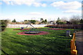
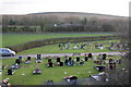
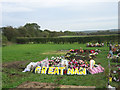
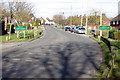
Photos of MK3 5ZW


Area Information
Living in MK3 5ZW means being part of a small, tightly knit residential cluster in England, home to 1,768 residents. This area is defined by its compact nature, with most homes situated in a way that balances proximity to local amenities and a quieter, more community-focused environment. The demographic profile suggests a mature population, with a median age of 47 and the majority of residents falling within the 30–64 age range. Daily life here is shaped by the availability of nearby schools, retail outlets, and rail connections, which collectively support a practical, low-maintenance lifestyle. The area’s small size means that residents can easily access essential services without long commutes. For those prioritising convenience and a stable, established community, MK3 5ZW offers a straightforward alternative to larger urban centres. Its proximity to Bletchley and surrounding towns ensures that residents have access to broader opportunities while retaining the benefits of a localised, manageable living environment.
- Area Type
- Postcode
- Area Size
- Not available
- Population
- 1768
- Population Density
- 2388 people/km²
The property market in MK3 5ZW is characterised by a strong emphasis on owner-occupation, with 61% of homes owned by residents. This suggests a stable, long-term market where properties are less likely to be rented out short-term. The accommodation type is predominantly houses, which contrasts with areas where flats or apartments dominate. This housing stock likely appeals to families or individuals seeking more space and privacy, though the small size of the area means that the housing stock is limited in scale. Buyers should consider that the market is not highly competitive, given the low population and modest property numbers. However, the proximity to Bletchley and its rail links may offer opportunities for those looking to expand their search slightly beyond MK3 5ZW while still benefiting from its localised amenities.
House Prices in MK3 5ZW
No properties found in this postcode.
Energy Efficiency in MK3 5ZW
The lifestyle in MK3 5ZW is shaped by its proximity to essential amenities. Within practical reach are five retail outlets, including Co-op Newton and Tesco Bletchley, offering everyday shopping needs. The rail network provides easy access to Bletchley and other nearby stations, facilitating travel to larger towns or cities. While the area does not have named parks or leisure facilities in the provided data, the presence of multiple schools and retail options suggests a focus on practicality over expansive recreational spaces. The community feel is likely enhanced by the compact size of the area, fostering a sense of familiarity among residents. For those prioritising convenience and accessibility, MK3 5ZW offers a straightforward lifestyle with minimal need for long commutes or complex planning.
Amenities
Schools
MK3 5ZW is served by several primary schools, including Alex Campbell Middle School, St Thomas Aquinas Catholic Primary School, and Chestnuts Primary School. Ofsted ratings are available for two of these institutions, with both Chestnuts Primary Schools receiving a ‘good’ rating. This mix of school types provides families with options, though the absence of secondary schools in the immediate area means that students may need to travel to nearby towns for further education. The presence of multiple primary schools suggests a focus on early education, which is likely to be a priority for families in the area. The ‘good’ ratings indicate that at least some schools meet or exceed national standards, though parents should verify the specific needs of their children when considering the area.
| Rank | School | Type | Entry gender | Ages |
|---|
Explore more schools in this area
Go to Schools tabDemographics
MK3 5ZW’s population is predominantly composed of adults aged 30–64, with a median age of 47. This suggests a community that is largely settled, with fewer young families or elderly residents compared to other areas. Home ownership is strong, with 61% of properties owned by their occupants, indicating a stable housing market and a preference for long-term residency. The accommodation type is primarily houses, which aligns with the area’s character as a residential cluster rather than a high-density development. The predominant ethnic group is White, reflecting a homogeneous demographic profile. While specific data on deprivation is not provided, the high home ownership rate and the presence of local amenities suggest a relatively stable quality of life. The absence of significant diversity metrics means the area may appeal to those seeking a consistent, familiar social environment.
Household Size
Accommodation Type
Tenure
Ethnic Group
Religion
Household Composition
Age
Household Deprivation
NS-SEC
Explore more demographic insights in this area
Go to Demographics tabPlanning
Planning Constraints
- Flood RiskPremium
- Ramsar Wetland SitesPremium
- Area of Outstanding Natural BeautyPremium
- Protected Nature ReservePremium
- Protected WoodlandPremium