Area Overview for MK3 5FJ
Photos of MK3 5FJ

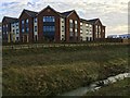


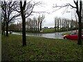
33 photos from this area
Area Information
Key information about the MK3 5FJ including its size, population, and administrative classification.
- Area Type
- Postcode
- Area Size
- 8362 m²
- Population
- 1919
- Population Density
- 867 people/km²
House Prices in MK3 5FJ
43
Properties
£272,524
Average Sold Price
£64,000
Lowest Price
£570,000
Highest Price
Showing 43 properties
| Address | Type | Beds | Baths | Last Sale Price | Last Sale Date | |
|---|---|---|---|---|---|---|
| 19 St Helena Avenue, Newton Leys, Milton Keynes, MK3 5FJ | house | 2 | 1 | £70,000 | Dec 2024 | |
| 59 St Helena Avenue, Newton Leys, Milton Keynes, MK3 5FJ | Flat | - | - | £69,000 | Nov 2023 | |
| 27 St Helena Avenue, Newton Leys, Milton Keynes, MK3 5FJ | Flat | 2 | 1 | £150,000 | May 2022 | |
| 75 St Helena Avenue, Newton Leys, Milton Keynes, MK3 5FJ | house | - | - | £330,000 | Mar 2022 | |
| 79 St Helena Avenue, Newton Leys, Bletchley, MK3 5FJ | Flat | 2 | 2 | £570,000 | Jan 2022 | |
| 5 St Helena Avenue, Newton Leys, Milton Keynes, MK3 5FJ | house | 4 | 3 | £370,000 | Sep 2021 | |
| 71 St Helena Avenue, Newton Leys, Milton Keynes, MK3 5FJ | Terraced | 3 | 3 | £270,000 | Mar 2021 | |
| 1 St Helena Avenue, Newton Leys, Milton Keynes, MK3 5FJ | house | 3 | 2 | £439,000 | Nov 2020 | |
| 73 St Helena Avenue, Newton Leys, Milton Keynes, MK3 5FJ | Terraced | 3 | 3 | £285,000 | May 2020 | |
| 61 St Helena Avenue, Newton Leys, Milton Keynes, MK3 5FJ | Flat | - | - | £64,000 | Feb 2020 |
Page 1 of 5
Energy Efficiency in MK3 5FJ
Amenities
Schools
| Rank | School | Type | Entry gender | Ages |
|---|
Explore more schools in this area
Go to Schools tabDemographics
Household Size
Family (3-5 people)
most common
Accommodation Type
Houses
most common
Tenure
73
majority
Ethnic Group
White
most common
Religion
N/A
most common
Household Composition
N/A
most common
Age
47
median
Adults (30-64 years)
most common
Household Deprivation
N/A
with no deprivation
NS-SEC
46
in Lower managerial occupations
Explore more demographic insights in this area
Go to Demographics tabPlanning
Planning Constraints
- Flood RiskPremium
- Ramsar Wetland SitesPremium
- Area of Outstanding Natural BeautyPremium
- Protected Nature ReservePremium
- Protected WoodlandPremium