Area Overview for MK3 5DW
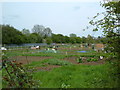
Photos of MK3 5DW


Area Information
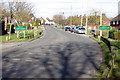
MK3 5DW is a small residential postcode area in England, home to 1,768 residents. Its compact size fosters a close-knit community feel, with housing focused on family-friendly properties. The area’s demographic profile suggests a mature population, with a median age of 47 and most residents aged between 30 and 64. This reflects a stable, long-term settlement pattern, with 61% of homes owned by residents rather than rented. Daily life here is shaped by proximity to essential services, including multiple primary schools and nearby rail stations. The area’s low crime risk score of 75 and absence of flood or environmental constraints make it appealing for those prioritising safety and reliability. While the population is small, the cluster of amenities within practical reach—such as Co-op and Tesco stores—offers convenience without the density of larger urban centres. For buyers, MK3 5DW represents a blend of practicality and tranquillity, ideal for those seeking a settled, family-oriented environment without sacrificing access to key infrastructure.
- Area Type
- Postcode
- Area Size
- Not available
- Population
- 1768
- Population Density
- 2388 people/km²
MK3 5DW is characterised by a strong owner-occupied market, with 61% of homes owned by residents. The accommodation type is predominantly houses, which are often semi-detached or detached, suggesting a suburban or semi-rural setting. This contrasts with areas dominated by flats or rental properties, and implies a more settled population. The small size of the postcode area means the housing stock is limited, with few new developments likely to arise. For buyers, this creates a niche market where properties are likely to be in long-term ownership, reducing turnover. The focus on houses also appeals to families seeking space and privacy. However, the limited number of properties means competition may be high, and buyers should consider the surrounding areas for additional options. The absence of rental-focused developments indicates a community prioritising stability over transient tenancy.
House Prices in MK3 5DW
No properties found in this postcode.
Energy Efficiency in MK3 5DW
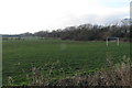
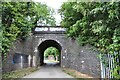
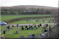
Living in MK3 5DW offers a practical lifestyle with essential amenities within reach. The area is served by five retail outlets, including Co-op Newton and Tesco Bletchley, providing access to groceries, household goods, and other daily necessities. Nearby rail stations—Bletchley, Fenny Stratford, and Bow Brickhill—offer easy access to public transport, supporting both local and regional travel. While the data does not specify parks or leisure facilities, the absence of planning constraints like protected nature reserves or AONB coverage suggests open spaces may be limited. However, the presence of multiple schools and retail options indicates a community-focused environment. The compact size of the area means amenities are closely grouped, reducing the need for long commutes. This blend of convenience and accessibility makes MK3 5DW suitable for those valuing practicality without sacrificing proximity to key services.
Amenities
Schools
MK3 5DW is served by several primary schools, including Alex Campbell Middle School and St Thomas Aquinas Catholic Primary School, both of which are rated 'good' by Ofsted. Chestnuts Primary School appears twice in the data, though only one instance notes its 'good' rating. The presence of multiple primary schools within the area offers families choice and convenience, reducing the need for long commutes. The 'good' Ofsted ratings suggest a generally high standard of education, though no secondary schools are listed in the data. This mix of schools supports a family-oriented community, with primary education readily accessible. However, parents seeking secondary schooling may need to look beyond the immediate area. The density of primary options, combined with the area’s low crime risk, makes it attractive for families prioritising educational quality and safety.
| Rank | School | Type | Entry gender | Ages |
|---|
Explore more schools in this area
Go to Schools tabDemographics
The population of MK3 5DW is predominantly adults aged 30 to 64, with a median age of 47. This suggests a community of established professionals and families, rather than a younger or elderly demographic. Home ownership is strong, with 61% of residents living in properties they own, compared to 39% renting. The accommodation type is primarily houses, indicating a mix of semi-detached and detached homes typical of suburban areas. The predominant ethnic group is White, reflecting the area’s demographic composition. While no specific data on deprivation is provided, the high home ownership rate and low crime risk imply a relatively stable socioeconomic environment. The absence of detailed diversity metrics means the community’s cultural makeup remains less defined in the data, but the focus on family-oriented housing and mature age groups suggests a cohesive, long-term resident base.
Household Size
Accommodation Type
Tenure
Ethnic Group
Religion
Household Composition
Age
Household Deprivation
NS-SEC
Explore more demographic insights in this area
Go to Demographics tabPlanning
Planning Constraints
- Flood RiskPremium
- Ramsar Wetland SitesPremium
- Area of Outstanding Natural BeautyPremium
- Protected Nature ReservePremium
- Protected WoodlandPremium